Posts tagged Trig Pillar
Cycling The Viking Way and NCN 1 in Kent

Margate Beach


This was a 2-day weekend cycle adventure on the NCN 1 and 15 in Kent. For Brian and I it was a continuation of the Thames Barrier to Margate trip that we did earlier in the year. This time we returned to Whitstable to pick up the NCN 15 to follow it to the end at Dover. For day 2 we followed the NCN 1 back to Whitstable. At 145 km and mostly flat it’s an easy ride giving more than enough time for coffee and cake stops along the way.


Day 2: The Viking Way from Whitstable to Dover

Start: Premier Inn Whitstable hotel, Thanet Way, Whitstable, CT5 3DB
Finish: Premier Inn Dover Central (Eastern Ferry Terminal) hotel, Marine Court, Marine Parade, Dover, CT16 1LW
Distance: 79.5 km (49 miles)
Elevation change: + 554m / -602m (Net -48)
GPX File: get via Buy Me a Coffee
Other routes touched (walk): England Coast Path, Saxon Shore Way, Oyster Bay Trail, Wantsum Walk, Augustine Camino, Stonelees Trail, Miner’s Way Trail, Via Francigena
Other routes touched (cycle): NCN 15: Viking Way, NCN 16, EV5,
Pubs / Cafes on route: Lots, but we stopped at Westgate-on-Sea, Whitfield and Sandwich.
Maps:
- Canterbury & Isle of Thanet Map | Herne Bay, Deal & Whitstable | Ordnance Survey | OS Explorer Map 150
- Dover, Folkestone & Hythe Map | England Coast Path | Ordnance Survey | OS Explorer Map 138
Links:
Whitstable, Herne Bay, Reculver, Westgate-on-Sea, Margate, Broadstairs, Ramsgate, Sandwich, Whitfield, Dover


Our trip started at the Premier Inn on the southern edge of the town. From there it’s a 2.5 km cycle to the coast where, as it was Saturday, we stopped for Whitstable parkrun. The NCN 15 (not to be confused with the same numbered route in Leicestershire) runs from Whitstable to Dover, with the Reculver to Pegwell Bay section called the Viking Way.

As it passes through several sea-side towns there’s lots of options to stop for food and drink along the way. We planned to stop for breakfast in Margate but hunger got the better of us so we stopped early at Westgate-on-Sea. At Pegwell Bay there’s an option to return to Whitstable via the inland section of the Viking Way. That would make a great half-day trip, effectively a circuit of the Isle of Thanet, but we carried on south along the route 15.

After Pegwell Bay the route leaves the coast and heads in-land to Sandwich. We planned to have lunch there, mostly for the childish amusement of having a sandwich in Sandwich. We timed it badly though and arrived just as cafes were closing for the afternoon and the pubs were packed. As we were retuning there the next day we grabbed some quick food and moved on.

After Sandwich the route continues south, gradually climbing in elevation to the highest point of the day at Dover Castle. After this there’s a steep descent to Dover town centre where we stayed the night at the Marina.


Day 2: Dover to Whitstable via the NCN 1

Start: Premier Inn Dover Central (Eastern Ferry Terminal) hotel, Marine Court, Marine Parade, Dover, CT16 1LW
Finish: Premier Inn Whitstable hotel, Thanet Way, Whitstable, CT5 3DB
Distance: 64.7 km (40 miles)
Elevation change: - 554m / +602m (Net +48)
GPX File: get via Buy Me a Coffee
Other routes touched (walk): England Coast Path, Saxon Shore Way, Stour Valley Walk, Augustine Camino, Canterbury Middle Ring Walk, Canterbury Outer Ring Walk, Crab & Winkle Way
Other routes touched (cycle): NCN 1, NCN 15: Viking Way
OS Trig Pillar: TP5672 - Richborough Hill
Pubs / Cafes on route: Lots, but we stopped at Walmer, Sandwich, Fordwich and Canterbury
Maps:
- Canterbury & Isle of Thanet Map | Herne Bay, Deal & Whitstable | Ordnance Survey | OS Explorer Map 150
- Dover, Folkestone & Hythe Map | England Coast Path | Ordnance Survey | OS Explorer Map 138
Links:
Dover, White Cliffs of Dover National Trust, Walmer Sandwich, Fordwich, Canterbury, Canterbury and Whitstable Railway, Whitstable


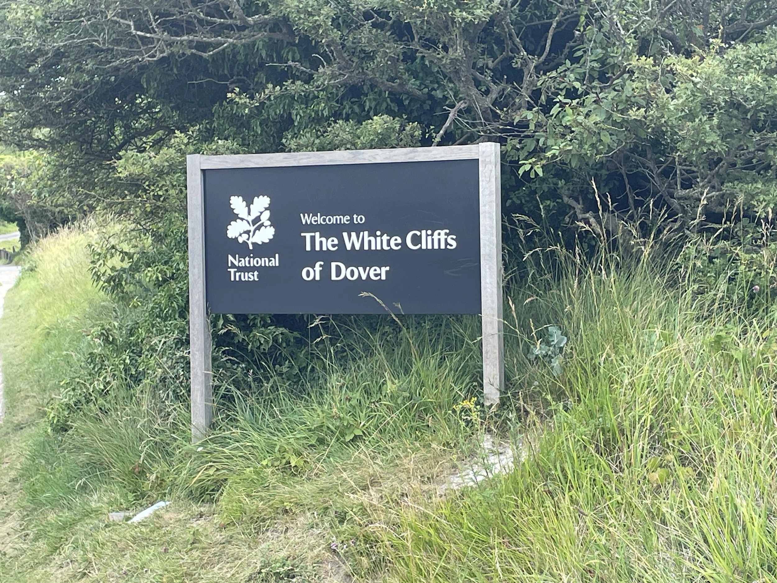
For our return leg to Whitstable we followed the NCN 1, completing the London to Dover section that we started in our trip earlier in the year. The first section is very steep and follows a narrow path up to the top of the White Cliffs of Dover. We were an hour away from fully waking up so made the easy choice to slowly walk the bikes up the cliffs. From the top there were great views over the Channel and back to Dover Castle while we recovered from the climb.

From the top the route has an 8 km steady downhill section to the coast at Kingsdown to make up for the earlier climb. This coastal section was one of my favourite parts of the 2-dy trip with its mix of quiet country lanes and easy riding along the sea-front. We were not in a rush so decided to maximise the coffee and cake stops with the first one at Walmer. Stop #2 was in Sandwich where we had a lot more success than the previous day with cafes actually being open and wanting to sell us food.

The middle section from Sandwich to Canterbury was flat and pleasant but not particularly memorable. We pushed on to Canterbury for a long lunch near the Cathedral. The final section from Canterbury was far more interesting as it mostly follows a disused railway nicknamed the Crab and Winkle line.

This was a very easy weekend, both from a logistics and a cycling perspective. If you don’t have a hole weekend then it can be split into 2 shorter circles with Sandwich as the split.


The Full 2-Day Route

Day 1 in blue, Day 2 in red


The Millennium Mileposts

Dotting the UK's National Cycle Network are over 1,000 unique markers known as the Millennium Mileposts. Unveiled in 2000, these cast-iron sculptures are more than just waymarkers. Designed by four artists, one from each nation of the UK, they celebrate the diversity of the cycling routes. These artistic mileposts come in various shapes and can be found in both bustling towns and scenic landscapes, adding a touch of artistic charm to a cycling adventure.

Here’s the 21 Mileposts that I spotted on the 2 day cycle trip. The first 2 were on the Viking Way on Day 1 and the rest were on the NCN 1 on Day 2.


West Midlands High Points

The West Midlands, a Ceremonial County in the heart of England, was formed ass result of a series of political and administrative changes that took place over centuries. Before the creation of the West Midlands, the region was divided into Staffordshire, Warwickshire and Worcestershire, The Local Government Act of 1974 marked a significant turning point in the history of the West Midlands. This legislation abolished the existing county boundaries and created a new county, the West Midlands. Today the 7 sub-divisions of the West Midlands are Metropolitan Boroughs.

For county-top hill-baggers, the region is, be honest, not very interesting. There’s a few good views but they’re mostly drive-bys in areas you’re not likely to go to unless you lived there or had an obscure hill-bagging obsession. If you’re in the latter camp, here’s a guide to the high points of the West Midlands. Click on the Blog Post link for each summit shown below for details on each.


Birmingham

Highest Point: Rednall Hill North Top, 250m
Historic County of High Point: Worcestershire (of which Worcestershire Beacon is the County Top)
OS Trig Pillar: N/A, nearest is TP4411 - Lickey Hill
Links: Blog Post, Wikipedia (Birmingham), Peakbagger, Hillbagging
Flag shown is the official flag of Birmingham


Coventry

Highest Point: Corley Moor, 167m
Historic County of High Point: Warwickshire (of which Ebrington Hill is the County Top)
OS Trig Pillar: N/A, nearest is TP2413 - Corley Resr
Links: Blog Post, Wikipedia (Coventry), Peakbagger, Hillbagging
Flag shown is the official flag of Coventry


Dudley

Highest Point: Cawney Hill, 251m
Historic County of High Point: Staffordshire (of which Cheeks Hill is the County Top)
OS Trig Pillar: N/A, nearest is TP1060 - Barrow Hill
Links: Blog Post, Wikipedia (Dudley), Peakbagger, Hillbagging
Flag shown is the work of Andy Underscore


Sandwell

Highest Point: Turner’s Hill, 271m
Historic County of High Point: Staffordshire (of which Cheeks Hill is the County Top)
OS Trig Pillar: N/A, nearest is TP6743 - Warley Resr
Links: Blog Post, Wikipedia (Sandwell, Turner’s Hill), Peakbagger, Hillbagging
Flag shown is the work of Andy Underscore


Solihull

Highest Point: Meigh’s Wood, 185m
Historic County of High Point: Warwickshire (of which Ebrington Hill is the County Top)
OS Trig Pillar: N/A, nearest is TP3975 - Hollyberry End
Links: Blog Post, Wikipedia (Solihull), Peakbagger, Hillbagging


Walsall

Highest Point: Barr Beacon, 227m
Historic County of High Point: Staffordshire (of which Cheeks Hill is the County Top)
OS Trig Pillar: TP1049 - Barr Beacon Resr
Links: Blog Post, Wikipedia (Walsall, Barr Beacon), Peakbagger, Hillbagging
Flag shown is the work of Andy Underscore


Wolverhampton

Highest Point: Sedgley Beacon, 235m
Historic County of High Point: Staffordshire (of which Cheeks Hill is the County Top)
OS Trig Pillar: N/A, nearest is TP5243 - Orton Hill
Links: Blog Post, Wikipedia (Wolverhampton, Beacon Hill), Peakbagger, Hillbagging
Flag shown is the work of Andy Underscore


The Metropolitan Boroughs of West Midlands, with the highest points grouped by Historical County.
Note that not all of each Metropolitan Borough was fully inside each Historical County shown here.


Barr Beacon: Walsall High Point

Barr Beacon War Memorial

Significance: Metropolitan Borough High Point for Walsall
Parent Peak: Walton Hill
Nearest Higher Neighbour: Turner’s Hill
Historic County: Staffordshire (of which Cheeks Hill is the County Top)
Elevation: 227m
Date climbed: July 27th 2024
Coordinates: 52° 34' 24'' N, 1° 54' 40'' W


Route Start / End: Parking at Beacon Road, Aldridge, Walsall, WS9 0QW
Route Distance: 0.8 km (0.5miles)
Route Elevation Change: +/- 4m
GPX File: get via Buy Me a Coffee
Other routes touched (walk): Beacon Way
OS Trig Pillar: TP1049 - Barr Beacon Resr
Map: Birmingham Map | Walsall, Solihull & Redditch | Ordnance Survey | OS Explorer Map 220
Links: Wikipedia (Walsall, Barr Beacon), Peakbagger, Hillbagging


Barr Beacon is the high point of the Metropolitan Borough of Walsall, within the Historic County of Staffordshire and Ceremonial County of West Midlands.

After our Wrekin walk earlier in the day we got talking to a guy in a pub where we were having lunch. He overheard our conversation about the day’s hill-bagging and offered us some advice. For Barr Beacon his main advice was “don’t go there unless you want to have your car stolen” … and especially don’t go there at night. We couldn’t really tell if he was joking or not but we were definitely going to bag it and had no intention of going there at night anyway.

Barr Beacon is a high, narrow ridge with views to the east and west. There’s a large car park at the top and the summit, near the War Memorial, can be done in a few minutes. We got there early afternoon on a Saturday and, although there were some dodgy looking cars, there were also families around having picnics.

The OS Trig Pillar is a little further north from the high point and in private land protected by a metal fence. There’s a spot in the fence with a post missing to the right of the road where it curves down the hill. If you can find that you can squeeze through and climb through the hedge into the field to bag the pillar. It’s fairly unpleasant as you need to climb over some fly-tipped debris and avoid the tree that has been used as a toilet.

Having bagged the high point and Tig Pillar we were happy to see that our cars were still there.


The Wrekin: Telford and The Wrekin High Point

View to the toposcope and transmitter from the Trig Pillar


Significance: Unitary Authority High Point for Telford and The Wrekin
Nearest Higher Neighbour: Caer Caradoc Hill
Historic County: Shropshire (of which Brown Clee Hill is the County Top)
Elevation: 407m
Date climbed: July 27th 2024
Coordinates: 52° 40' 9'' N, 2° 33' 5'' W


Route Start / End: The Wrekin Forest Glen Car Park, Little Wenlock, Telford, TF6 5AL
Route Distance: 7.2 km (4.5 miles)
Route Elevation Change: +/- 307m
Subsidiary tops on route: Little Hill (232m)
GPX File: get via Buy Me a Coffee
Other routes touched (walk): Telford T50, Shropshire Way
OS Trig Pillar: TP0712 - Wrekin
Map: Telford, Ironbridge & The Wrekin Map | Ironbridge Gorge | Ordnance Survey | OS Explorer Map 242
Links: Wikipedia (Telford and The Wrekin, The Wrekin), Peakbagger, Hillbagging


The Wrekin was the literal high point of a day of bagging High Points of the West Midlands. The rest were quick drive-bys in obscure and often dodgy areas so we made the most of the Wrekin trip to make it a circular rather than an out-and-back.

Like most people we started at The Wrekin Forest Glen Car Park. It gets full quickly in the summer but we were lucky and got a space. The annoying thing was that payment is only by credit card or via an app that I’d never seen before. The card machine wasn’t working and there was no mobile signal so we ended up having to pay on-line half-way up the ascent.

With parking drama out of the way we took the shortest route to the summit on the Telford 50 trail. We were there on a clear day so we got a great view at the top across to Wales on the western side and Staffordshire on the east. The summit has an OS trig pillar, a toposcope, a transmitter tower and the remains of an Iron Age fill fort.

From the top we continued walking south-west for another 1 km down to Little Hill. It was marked on the map so we thought we’d check it out but there was little to mark it and no view. Continuing another 20m we took a left onto a footpath, then another left to pick up a path that lead us back to the car-park on a lower level.


High Points of The Sussex Rapes

The English county of Sussex holds a unique historical term that can raise eyebrows: the "Rapes." Unlike modern definitions, the term in Sussex refers to a historical administrative division. The origin of the term "Rape" for these regions is shrouded in mystery. Theories range from a possible link to the Old English word "raep," meaning "harvest," to a connection with the Danish word "rape," signifying "district."

The Historic County of Sussex has six Rapes: Arundel, Bramber, Chichester, Hastings, Lewes, and Pevensey. Established sometime before the Norman Conquest of 1066, these Rapes likely predate the current county borders. Each Rape contained smaller subdivisions called "Hundreds," forming the backbone of local administration for centuries. Some historians believe the Rapes might have originated as defensive units, with each Rape centered around a strategically placed castle. This theory aligns with the arrival of the Normans, who are known to have built fortifications across England.

The Rapes continued to be used for administrative purposes for centuries, but their importance gradually declined. By the 19th century, their role had largely been superseded by more modern administrative structures. Today, the Rapes of Sussex remain a fascinating relic of the county's past. Though no longer serving an administrative function, they hold cultural significance and continue to spark curiosity.


Rape of Chichester

Rapal Town: Chichester
Norman Castle: Chichester Castle
Highest Point: Black Down, 280 metres, is also the Historic County Top of Sussex, the Present-Day County Top of West Sussex and the highest point in the South Downs National Park.
OS Trig Pillar: TP1443 - Blackdown
Links: Blog Post, Wikipedia, Peakbagger, Hillbagging


Rape of Arundel

Rapal Town: Arundel
Norman Castle: Arundel Castle
Highest Point: Glatting Beacon, 245 metres
OS Trig Pillar: TP1358 - Bignor Beacon
Links: Blog Post, Wikipedia, Peakbagger, Hillbagging


Rape of Bramber

Rapal Town: Bramber
Norman Castle: Bramber Castle
Highest Point: Chanctonbury Hill, 242 metres
OS Trig Pillar: TP2110 - Chanctonbury Ring
Links: Blog Post, Wikipedia, Peakbagger, Hillbagging


Rape of Lewes

Rapal Town: Lewes
Norman Castle: Lewes Castle
Highest Point: Ditchling Beacon, 248 metres, is the Present-Day County Top of East Sussex.
OS Trig Pillar: TP0760 - Ditchling
Links: Blog Post, Wikipedia, Peakbagger, Hillbagging


Rape of Pevensey

Rapal Town: Pevensey
Norman Castle: Pevensey Castle
Highest Point: Crowborough Beacon, 242 metres, is also the high point of the High Weald National Landscape.
OS Trig Pillar: TP2630 - Crowborough
Links: Blog Post, Wikipedia, Peakbagger, Hillbagging


Rape of Hastings

Rapal Town: Hastings
Norman Castle: Hastings Castle
Highest Point: Brightling Down, 197 metres
OS Trig Pillar: N/A. Closest is TP4140 - Jurys Gut
Links: Blog Post, Wikipedia, Peakbagger, Hillbagging


Glatting Beacon: Rape of Arundel High Point

View to Glatting Beacon from the South Downs Way

Also known as: Bignor Hill
Significance
: Highest point in the Rape of Arundel
Parent Peak: Butser Hill
Nearest Higher Neighbour: Littleton Down
Present Day County: West Sussex (of which Black Down is the County Top)
Elevation: 245m
Date climbed: July 20th 2024
Coordinates: 50° 55' N, 0° 38' W


Route Start / End: South Downs Way Parking, Chichester, RH20 1PH
Route Distance: 2.8 km (1.7 miles)
Route Elevation Change: +/- 37m
GPX File: get via Buy Me a Coffee
Other routes touched (walk): South Downs Way
OS Trig Pillar: TP1358 - Bignor Beacon
Map: Arundel & Pulborough Map | Worthing & Bognor Regis | Ordnance Survey | OS Explorer Map OL10
Links: Wikipedia (Rape of Arundel, Bignor Hill), National Trust Slindon Estate, Peakbagger, Hillbagging


Like Chanctonbury Hill which we visited earlier in the day, I could have bagged this one on an earlier trip along the South Downs Way. It’s easily accessible as a small diversion from the National Trail and hard to miss (look for the big transmitter in the trees).

We bagged it on a short circular walk from the Bignor Hill South Downs Way Car Park. From the parking, follow the South Downs Way in a westerly direction for ~280m then take a right hand path ascending towards the big transmitter. Near the top, take the service track to the transmitter where you’ll find the Trig Pillar lurking in the undergrowth.

Either return the way you came or return to the main path that you were on, take 2 lefts and you’re back on the South Downs Way. Take another left to follow the Trail back to the car park.


Chanctonbury Hill: Rape of Bramber High Point

View to Chanctonbury Ring from the Trig Pillar


Also known as: Chanctonbury Ring
Significance
: Highest point in the Rape of Bramber
Member of: Marilyns
Parent Peak: Ditchling Beacon
Nearest Higher Neighbour: Ditchling Beacon
Present Day County: West Sussex (of which Black Down is the County Top)
Elevation: 242m
Date climbed: July 20th 2024
Coordinates: 50° 53' 48'' N, 0° 22' 54'' W


Route Start / End: Chanctonbury Ring Car Park, Chanctonbury Ring Road, Steyning, BN44 3DR
Route Distance: 4.3 km (2.7 miles)
Route Elevation Change: +/- 154m
GPX File: get via Buy Me a Coffee
Other routes touched: South Downs Way,
OS Trig Pillar: TP2110 - Chanctonbury Ring
Map: Arundel & Pulborough Map | Worthing & Bognor Regis | Ordnance Survey | OS Explorer Map OL10
Links: Wikipedia (Rape of Bramber, Chanctonbury Hill, Chanctonbury Ring), Peakbagger, Hillbagging


I very nearly bagged Chanctonbury Ring a few years back while cycling the South Downs Way. We stopped to visit the nearby Trig Pillar but I didn’t realise that the Rape of Bramber High Point was so close. So, on a day of bagging my remaining Sussex high points, Mark and I revisited for a short, steep circular walk to visit both the high point and the Trig Pillar.

To follow the same route start at Chanctonbury Ring Car Park and follow Chanctonbury Ring Road in a southerly direction. Continue south as the road becomes a path that leads up to the South Downs Way. We took a short cut up a less-used, steeper path through the woods. It actually didn’t save much time as a guy that we saw taking the longer route arrived at the top at more or less the same time as we did.

Whichever route you take, turn right onto the South Downs Way and head towards the clump of trees that’s the site of the Iron Age hillfort. The South Downs Way goes round the trees on their southern side so you’ll need to leave the trail to follow a smaller path through the trees. The high point isn’t marked but easy to find. From the high point continue west out of the trees to briefly rejoin the South Downs Way before cutting off again to the Trig Pillar.

To return follow the fence to the north of the Trig Pillar back towards Chanctonbury Ring to find a gate and a path that leads back down the hill in a north-westerly direction. At the bottom of the hill take a right on another path that leads back to Chantonbury Ring Road near to the Car Park.


Crowborough Beacon: Rape of Pevensey High Point

View to the south-west from Crowborough Beacon Golf Club


Significance: Highest point in the Rape of Pevensey, High Point of High Weald National Landscape
Member of: Marilyns
Parent Peak: Ditchling Beacon
Nearest Higher Neighbour: Ditchling Beacon
Present Day County: East Sussex (of which Ditchling Beacon is the County Top)
Elevation: 242m
Date climbed: July 20th 2024
Coordinates: 51° 3' 17'' N, 0° 9' 15'' E


Route Start / End: Croft Road Car Park, Pine Grove, Crowborough, TN6 1AR
Route Distance: 3.9 km (2.4 miles)
Route Elevation Change: +/- 47m
GPX File: get via Buy Me a Coffee
Other routes touched: None
OS Trig Pillar: TP2630 - Crowborough
Map: Ashdown Forest Map | Royal Tunbridge Wells, East Grinstead, Haywards Heath & Crowborough | Ordnance Survey | OS Explorer Map 135
Links: Wikipedia (Rape of Pevensey, Crowborough, High Weald), Peakbagger, Hillbagging


I had high hopes for Crowborough as it has “Beacon” in it’s name as is the high point of both the Rape of Pevensey and The High Weald. It turns out that there’s not much to see. The high point is an unmarked spot outside a house called Deep Dene on Warren Road. It can easily be bagged as a drive-by but we chose to park in Crowborough village centre and bag it as a part of a short circular walk.

To follow the same route leave Croft Road Car Park and head north to join the A26 Beacon Road. Take a left onto the A26 and walk in a south-westerly direction for ~700m to the water reservoir opposite Beacon Road West. Here you’ll find the OS Trig Pillar next to a small brick building. Continue south for ~25m to reach the high point at Warren Road.

Continue further south along the A26 to a footpath at the edge of the woods at 2 km into the walk. This is a point marked in Peakbagger as Crowborough South Slope, the High Point of the High Weald. Although Crowborough is completely within The High Weald, the town isn’t part of the National Landscape, so this is technically the highest point rather than the spot at Deep Dene.

Take a left onto South View Road to find the best and only panoramic view of the walk across Crowborough Golf Course. Continue along South view road, then onto Croft Road to return to the Car Park


Brightling Down: Rape of Hastings High Point

Brightling Obelisk


Significance:  Highest point in the Rape of Hastings
Parent Peak: Crowborough Beacon
Nearest Higher Neighbour: Crowborough Beacon
Present Day County: East Sussex (of which Ditchling Beacon is the County Top)
Elevation: 197m
Date climbed: July 20th 2024
Coordinates: 50° 58' N, 0° 23' E


Route Start / End: Small parking spot at junction of Willingford Lane and Mill Lane
Route Distance: 0.6 km (0.4 miles)
Route Elevation Change: +/- 3m
GPX File: get via Buy Me a Coffee
Other routes touched: None
OS Trig Pillar: TP4140 - Jurys Gut (not at the high point, but ~1 km to the south)
Map: Hastings & Bexhill Map | Battle & Robertsbridge | Ordnance Survey | OS Explorer Map 124
Links: Wikipedia (Rape of Hastings, Brightling, Brightling Park), Peakbagger, Hillbagging


The high point of the Rape of Hastings can be found on the edge of the private Brightling Park, currently home to a racehorse training company. The summit is hard to miss as it’s marked by a large obelisk called The Brightling Needle. If you don’t mind a bit of minor trespassing its a 600m out and back walk from a small parking space near the junction of Willingford Lane and Mill Lane.

If you’re no up for tresspassing then don’t hop over the gate into the small wooded area at the south eastern end of Willingford Lane. Don’t follow the track through the woods and hop over another fence into the field, then follow the track up to the Obelisk. Instead, you can see the Obelisk through the fence further down Willingford Lane. Alternatively you can ask permission from the landowner to access the land.

While you’re in the area it’s worth visiting Jury’s Gut, an OS Trig Pillar located 1km to the south on a path next to a kiln-shaped folly called The Sugarloaf.


Isla de Lobos, Fuerteventura

Punta Martiño Lighthouse on the northern tip of the island


The Canary Islands are a regular choice for us to spend our end-of-winter holidays. They’re always warm in February and, at 4 hours flight time, they’re about as far as we want to travel for a one week trip.

Our goal for these trips is always resting over adventure and I’ve learned not to get over-excited about ticking off everything on the islands. We’ve missed most of the highest points either due to weather or length of walk. Due to this we’ve managed to successfully miss the highest points on Tenerife, Lanzarote and La Gomera. We did manage to get to the Gran Canaria summit although that’s only the highest accessible point very close to the actual high point.

So, on our week in Fuerteventura I had written off the high point even before we left the UK. Pico de la Zarza is not a very difficult hike but it was too long and too hot for our relaxing break. I added it to the list of the other Canary High Points to cover later on a different type of trip at at a different time of year.

My need for high point bagging ended up being satisfied by a trip to a small island just off the north coast of Fuerteventura. Isla de Lobos is a 5k / 15 minute ferry ride from Corralejo harbour. It has well-marked hiking trails totaling 10k and an out-and-back ascent of Montaña La Caldera.

We took the 12:30 foot ferry run by Naviera Nortour. By the time all the tourists had stopped their faffing on and off the boat it was 13:00 before we started the hike. This gave us a full 3 hours on the island before needing to be back at 16:00 for the 16:15 return ferry.

We had read on other blogs that the 10k circuit takes 2 and a quarter hours to complete. That would be a very fast pace, especially if including the high point. We walked at a steady pace, stopped for lunch 15 minutes at the lighthouse and took the full 3 hours.

We took the anticlockwise route having seen a recommendation in another blog post that this would be the less popular route. Everyone with us that day must have read the same post as most people were going the same was as us.

A few minutes later east of the ferry pier is El Puertito where there’s a pretty bay and a restaurant. We passed through it quickly as it was already crowded. From there we took a side route from the main path that takes in Las Lagunitas.

The paths around the island are well maintained and mostly flat. When you get to the lighthouse be prepared for a short climb up the hill. You’re now roughly half way into the walk and a good place for photos and a rest.

After the lighthouse return to the base and take the right hand path, now on GR131. After 3.5 km you’ll reach the spur to climb the hill to the high point. If you don’t fancy it you can carry straight on back to the ferry pier.

The weather had changed for the second half of our walk and we had some light rain on the approach. As we started ascending the rain stopped and some heavy wind started. Timea got to around 100m of elevation and decided that was enough for her as she didn’t want to be blown off back to the mainland.

I continued the remaining 10 mins to the summit to reach the Trig Pillar, get a few photos and tried not to be blown off. Even that day there were great views to both Fuerteventura and Lanzarote but I didn’t hang around for long to admire them.

From the path junction to the Montaña it’s another 20 minutes walk back to the ferry pier.

With a new island and a high point bagged I was now happy to head back to the hotel to relax for the rest of the trip.


The Hike

Start / Finish: Lobos Island Ferry Pier
Distance:
9.9 km (6.1 miles)
Elevation Change: +/- 128m
GPX File: get via Buy Me a Coffee
Other Routes Touched (walk): GR131 Camino Natural de Fuerteventura
Cafe / pub on route: Chiringuito Lobos Antoñito El Farero, 600m from the Ferry Pier
Guidebook: Walking on Lanzarote and Fuerteventura (Cicerone)
Links: Fuerteventura, Corralejo, Lobos Island


Montaña La Caldera

Also known as: Caldera de Lobos
Significance:
Highest point on Isla de Lobos
Elevation: 127m (although listed as 124m on Peakbagger)
Date “climbed”: February 23rd 2024
Coordinates: 28° 45' 6'' N, 13° 49' 49'' W
Links: Peakbagger


Isla de Lobos from above


Chiltern Walks: Three walks from Swyncombe

From Walk 2: Swyncombe and Park Corner


This is part of a series of short circular walks in the Chilterns with 3 separate routes all starting from St Botolph's Church, Swyncombe in Oxfordshire. The guidance below will help you navigate but don’t use it as a fully accurate turn-by-turn guide. Always take a map and/or a GPX route and prepare well for the weather and terrain.

Each of the 3 walks touches combinations of sections of the Shakespeare’s Way, The Chiltern Way and The Ridgeway. If you’re following The Shakespeare’s Way series of walks through the Chilterns this post contains sections 2 and 3 taking you from The Ridgeway near Watlington to just south of Russell’s Water.


Details for All Routes:

Start & Finish: St Botolph's Church, Swyncombe, Henley-on-Thames, Oxfordshire, RG9 6EA
Map: OS Explorer Map (171) Chiltern Hills West, Henley-on-Thames and Wallingford
Links: Swyncombe, Ewelme


Route 1: Swyncombe and The North

Distance: 8.1 km (5 miles)
Elevation change: +/- 176m
GPX File: get via Buy Me a Coffee
Other routes touched (walk): The Ridgeway, The Chiltern Way, Shakespeare’s Way
Other routes touched (cycle): Chiltern Cycle Route
Pubs / Cafes on route: None

From St Botolph's Church follow The Ridgeway in a northerly direction for 3.7 km to meet the junction with the Shakespeare’s Way at Ridge Farm. Take a right to follow the Shakespeare’s Way for 3 km to Cookley Green. At Cookley Green take a right onto Church Lane to follow The Chiltern Way back to the start at St Botolph's Church.

Shakespeare’s Way Previous Section (north): Britwell Salome and Lower Warren
Shakespeare’s Way Next Section (south): Swyncombe & Park Corner (scroll down)


Route 2: Swyncombe and Park Corner

Distance: 9.9 km (6.2 miles)
Elevation change: +/- 199m
GPX File: get via Buy Me a Coffee
Other routes touched (walk): The Ridgeway, The Chiltern Way, Shakespeare’s Way
Other routes touched (cycle): Chiltern Cycle Route
Pubs / Cafes on route: None

From the southern side of St Botolph's Church follow The Chiltern Way in an easterly direction for 2.7 km to the Chiltern Way/Shakespeare’s Way path junction just west of Russell’s Water. Continue south for 800m to meet another Chiltern Way/Shakespeare’s Way path junction just west of the Five Horseshoes pub. Take a right to follow The Chiltern Way in a westerly direction for 3.9 km, passing through Park Corner, to reach The Ridgeway. Take a right onto The Ridgeway to follow it in a northerly direction back to the start at St Botolph's Church.

Shakespeare’s Way Previous Section (north): Swyncombe & The North (scroll up)
Shakespeare’s Way Next Section (south): Nettlebed, Park Corner and Maidensgrove


Route 3: Swyncombe and Ewelme

Distance: 10.7 km (6.6 miles)
Elevation change: +/- 232m
GPX File: get via Buy Me a Coffee
Other routes touched (walk): The Ridgeway, The Chiltern Way
Other routes touched (cycle): Chiltern Cycle Route
OS Trig Pillar: TP4072 - Huntingland
Pubs / Cafes on route: None

From St Botolph's Church follow The Ridgeway in a south-westerly direction for 1.5 km to a path junction before the manor house at Ewelme Park. Take a right on to this path heading north-west for 1 km to meet The Chiltern Way at a smelly pig-farm. Take a right to follow The Chiltern Way in a north-westerly direction to the outskirts of Ewelme village. Continue following The Chiltern Way for as it curves round to following an easterly direction connecting with The Ridgeway at Swyncombe Downs. Take a right to follow The Ridgeway (staying on The Chiltern Way too) back to the start at St Botolph's Church.

For OS Trig Pillar baggers, you can visit the Huntingland Trig Pillar which is just off The Chiltern Way at 7.2 km into this route. It’s in a field and easily accessible but best to visit in the winter when there’s no crops.


Hanging Hill: South Gloucestershire High Point

Hanging Hill summit is by the transmitter at Avon Fire and Rescue Service Southwest Command Development Centre


Start & Finish: Layby near Sir Bevil Grenville's Monument, Cotswold Way, Bath, BA1 9DD
Distance: 2.2 km (1.4 miles)
Elevation change: +/- 28m
GPX File: get via Buy Me a Coffee
Other routes touched (walk): Cotswolds Way
Other routes touched (cycle): N/A
Pubs / Cafes on route: None
Map: Bristol & Bath Map | Keynsham & Marshfield | Ordnance Survey | OS Explorer Map 155
Links: Bevil Granville, Sir Bevil Grenville's Monument, Battle of Lansdowne

Significance: High Point for the Unitary Authority of South Gloucestershire
Member of: N/A
Parent Peak: Beacon Batch
Nearest Higher Neighbour: Niver Hill
Historic County: Gloucestershire (of which Cleeve Hill is the County Top).
Elevation: 237m
Date “climbed”: December 30th 2023
Coordinates: 51° 25' 51'' N, 2° 24' 31'' W
OS Trig Pillar: TP3599 - Hanging Hill
Links: Wikipedia (South Gloucestershire), Peakbagger, Hillbagging


Hanging Hill is the High Point of the Unitary Authority of South Gloucestershire which was created after the abolition of the Ceremonial County of Avon. Having bagged 2 of of the 4 high points of the ex-Avon Unitary Authorities on a trip to the Mendips I was keen to get this one on the way back home. The 4th one, Dundry Hill, will have to wait for a future trip.

This high point can be bagged either on a short out-and-back or, as I did, a short circular. There’s free but limited parking off for the Sir Bevil Grenville's Monument on the road leading north from Landsdown. There were a lot of cars even on a cold winter day when when we arrived.

From the parking space follow the Cotswolds Way in a westerly direction along Beeches Cottages Road to the Avon Fire and Rescue Centre. The actual highpoint is in the grounds of the Fire and Rescue Centre, presumably under the large transmitter. The Centre was closed when I was there but you can get very close to it as the Cotswolds Way runs along side the perimeter fence.

Continue along the Cotswolds Way for another 500m to reach the Hanging Hill Trig Pillar. Along the way you’ll pass flags and information boards marking the site of the Battle of Lansdowne in 1643. After the Trig Pillar continue along the Cotswolds Way as it takes a sharp turn to the left now heading in a south/south-easterly direction. After another 500m you’ll reach the end of the field and the edge of some woods where you can leave the Cotswolds Way following a path through the woods back towards the main road. Take the path that cuts diagonally across the field heading north back to the parking area.


Brean Down, Somerset

Looking back to the mainland from the Brean Down Trig Pillar


Start & Finish: National Trust Brean Down Car Park, 2 Brean Down Road, Brean, Burnham-on-Sea TA8 2RS
Distance: 3 km (1.9 miles)
Elevation change: +/- 84m
GPX File: get via Buy Me a Coffee
Other routes touched (walk): England Coast Path
Other routes touched (cycle): N/A
OS Trig Pillar: TP1608 - Brean Down
Pubs / Cafes on route: Cafe at Brean Down National Trust, at start and end.
Map: Weston-super-Mare & Bleadon Hill Map | Burnham-on-Sea & Clevedon | Ordnance Survey | OS Explorer Active Map 153
Links: Brean Down, Brean Down National Trust, Hillbagging, Brean Down Fort


We visited the Brean Down Trig Pillar near the end of a short break in the Mendips between Christmas and New Year. The weather was terrible but we managed to bag a few high points and visit a few of the sea-side towns in the area. We arrived at the Brean Down National Trust car-park just as a downpour was starting. It cleared up quickly and we saw on the weather app that we had a dry spot of around 30 minutes before the rain came again. We took a risk to see if we could get to the Trig Pillar before the rain came back.

The path to the Trig Pillar starts at the National Trust cafe and ascends steeply to the top of the ridge up some stone steps. At the top of the steps take a left to follow the well-marked path that leads to the end of the peninsula. There’s a great views from 3 sides and we were treated to a vivid double rainbow to the north as a rainstorm passed by and over Weston-Super-Mare.

At the Trig Pillar I was keen to continue the walk to the end of the peninsula to visit the old fort. Timi sensibly called me back as our dry weather window was rapidly closing and we could see the storm clouds coming toward us. We retraced our steps back to the National Trust cafe just as the rain started again.


High Points of The Mendip Hills National Landscape

Trig Pillar at the summit of Beacon Batch


The County of Avon existed as a Ceremonial County between 1974 and 1996. It was comprised of parts of the former Historic Counties of Gloucestershire and Somerset and then, on abolition, split into 4 new Unitary Authorities. The high point of the County of Avon was Niver Hill North Top at 264m which is now the high point of the Unitary Authority of Bath and North East Somerset.

This post features 3 high points closely located to Blagdon Lake in the Mendips AONB:

  • Niver Hill: the high point of the former Ceremonial County of Avon and the present-day Unitary Authority of Bath and North East Somerset

  • Blagdon Hill Farm: the high point of the present-day Unitary Authority of North Somerset

  • Beacon Batch: the high point of the Mendips AONB

All three high points could be reached on a long walk combining the Limestone Link, Mendips Way, Monarch’s Way and The Butcombe Trail, however we split it into 2 shorter walks with a 10 minute drive between them. First up was a short circular walk taking in Beacon Batch and Blagdon Hill.


Beacon Batch and Blagdon Hill Farm Circular Walk

Start & Finish: Burrington Ham Car Park, Burrington Combe, Bristol, BS40 7TZ
Distance: 7.1 km (4.4 miles)
Elevation change: +/- 149m
GPX File: get via Buy Me a Coffee
Other routes touched (walk): Limestone Link, The Butcombe Trail
Other routes touched (cycle): None
Pubs / Cafes on route: None
Map: Cheddar Gorge & Mendip Hills West Map | Wells & Glastonbury | Ordnance Survey | OS Explorer Map 141
Links: Mendips Hills National Landscape, Mendip Hills (Wikipedia), Burrington Ham (Camp)

The obvious place to start this walk is the small parking area at Burrnington Ham on the north side of Burrington Combe road. If you’re really short on time and not bothered about Balgdon Hill Farm you can bag Beacon Batch on a 2.4km out-and-back from the parking area.

For the full 7.1 km circular walk take the footpath on the north-east side of the parking area that follows the Limestone Link to the east connecting with Luvers Lane. At the end of Luvers Lane take a right onto Two Trees (lane). Continue along Two Trees, heading south-east for around 600m and take a left onto Leaze Lane. The Blagdon Hill Farm High Point is 250m along this lane. There’s nothing to mark the summit but you get great views to the north over Blagdon Lake.

Continue east along Leaze Lane to the entrance of the farm and take the path on the right that heads south along field edges to the B3134 Broad Road. Take a right to follow Broad Road for ~300 metres then carefully cross over to the footpath on the south side of the road. Be very careful on this bit as it’s a busy road with no pavement but there is a small grass margin to avoid being on the road with the cars.

Follow the path as it zig-zags through fields in a southerly direction for just under 1 km to meet Rains Batch Road and the Butcombe Trail. Take a right and follow the road to the Wireless Station. Continue along the Butcombe Trail for another 1 km to the edge of the open space surrounding the Beacon Batch summit. Leave the Butcombe Trail to take a path heading north, north-west to the Trig Pillar marking the Mendips high point.

After the Trig Pillar take a northerly path the descend back down to the car park.


Blagdon Hill Farm

Significance: High Point for the Unitary Authority of North Somerset
Member of: N/A
Parent Peak: Beacon Batch
Nearest Higher Neighbour: Beacon Batch
Historic County: Somerset (of which Dunkery Beacon is the County Top). Was also part of the former Ceremonial County of Avon (of which Niver Hill was the County Top)
Elevation: 242m
Date “climbed”: December 28th 2023
Coordinates: 51° 19' 1'' N, 2° 42' 47'' W
Links: Wikipedia (North Somerset), Peakbagger, Hillbagging


Beacon Batch

Also known as: Black Down
Significance:
Mendips National Landscape High Point
Member of: Marilyns
Parent Peak: The Wrekin (according to Wikipedia although it seems unlikely)
Nearest Higher Neighbour: Lydeard Hill
Historic County: Somerset (of which Dunkery Beacon is the County Top)
Elevation: 325m
Date “climbed”: December 28th 2023
Coordinates: 51° 18' 44'' N, 2° 44' 27'' W
OS Trig Pillar: TP1472 - Blagdon
Links: Wikipedia (Mendip Hills, Black Down), Peakbagger, Hillbagging


Niver Hill North Top Out-and-back Walk

Start & Finish: Forestry England East Harptree Car Park, East Harptree, BS40 6DA
Distance: 2 km (1.2 miles)
Elevation change: +/- 27m
GPX File: get via Buy Me a Coffee
Other routes touched (walk): Monarch’s Way
Other routes touched (cycle): None
Pubs / Cafes on route: None
Map: Cheddar Gorge & Mendip Hills West Map | Wells & Glastonbury | Ordnance Survey | OS Explorer Map 141

Following the Beacon Batch and Blagdon Hill Farm walk it’s a 10 minute drive to the start of this shorter walk starting from the Harptree Car Park. From the car park entrance take a left onto Smitham Hill, then first right onto Nettwood Lane. Continue along Nettwood Lane until the farm entrance, then along the footpath, following the Monarch’s Way, along the edge of the field. The unmarked high point is in the south-eastern corner of this first field at the start of a row of trees. The boundary between Bath and Northeast Somerset and the County of Somerset runs along the field edge that you have just followed then takes a right angle following the hedge-line north towards the lake.

Retrace your steps back to the car park.

Niver Hill North Top

Significance: High Point for the Unitary Authority of Bath and North East Somerset
Member of: N/A
Parent Peak: Niver Hill
Nearest Higher Neighbour: Niver Hill
Historic County: Somerset (of which Dunkery Beacon is the County Top)
Elevation: 264m
Date “climbed”: December 28th 2023
Coordinates: 51° 16' 56'' N, 2° 37' 31'' W
Links: Wikipedia (Bath and North East Somerset), Peakbagger, Hillbagging


Botley Hill

Significance: Parent Peak of Betsom’s Hill (Kent County Top) and Westerham Heights (Greater London High Point), Highest Point of the North Downs
Member of:
Marylins
Parent Peak:
Leith Hill
Nearest Higher Neighbour
: Leith Hill
Historic County: Surrey
Elevation:
270m
Date “climbed”:
December 3rd 2023
Coordinates:
51° 16' 44'' N, 0° 0' 45'' W
OS Trig Pillar: TP1536 - Botley Hill
Map:
Sevenoaks & Tonbridge Map | Royal Tunbridge Wells & Westerham | Ordnance Survey | OS Explorer Map 147
Links:
-
Wikipedia (Botley Hill, North Downs)
- Peakbagger (at Water Tower, at Trig Pillar)
- Hillbagging (at Water Tower, at Trig Pillar)


I had only discovered Botley Hill recently when researching County Tops and routes in the area. It’s the high point of the North Downs, but doesn’t make it into any lists as the North Downs isn’t an AONB, National Park or similar. It’s taller than the nearby high points of Kent and Greater London, but is in Surrey so misses out to the 5m higher Leith Hill for the County Top. It’s a must-do though for high-point completists and more more interesting than both Betsom’s Hill and Westerham Heights, the high points of Kent and Greater London.

The Botley Hill summit is next to a water tower and transmitter and easily accessible by road. It’s also on the Vanguard Way, 1km north of its junction with the North Downs Way so can be bagged on a diversion from both. We bagged it on the same day as walking a section of the North Downs Way but drove to the Botley Hill summit after completing the walk.

The water tower summit isn’t the only significant point on the hill. There’s an OS Trig Pillar approximately 1 km to the east which was once considered to be the hill summit but is actually ~1m lower. We also visited this one as a drive-by after our North Downs Way walk.

Source: Legislation.gov.uk

For the absolute completists there’s also Botley Hill Northeast Slope. Peter Stone’s Peakbagger entry from March 2012 describes it as: “A 255 m slope feature inside a Reptile Zoo or behind adjacent Waylands House. Got as close as I could for a bona fide claim. However, perhaps a bit pointless and of historic interest only as this place is no longer the highpoint of Greater London since a boundary change ceded it to Surrey in 1993. Greater London's high point is now Westerham Heights, 245 m, a few km to the E and very close to Kent's top” .

The transfer between Bromley in Greater London and Surrey was actually on April 1st 1994, although the legislation had 1993 in the name. More information can be found in this article on legislation.gov.uk. The map to the right shows the southern tip of Bromley, previously the Greater London High Point, which moved to Surrey with this legislation.


The Botley Hill Family

Botley Hill is the Parent Peak to:
- Botley Hill Trig Pillar and Botley Hill Northeast Slope
- Betsom’s Hill, the County Top of Kent
- Toy's Hill, the High Point of the Kent Downs AONB
- Westerham Heights, the High Point of Greater London and the London Borough of Bromley
- All Greater London Borough High Points south of the Thames plus Heston The Vale (Hounslow)


Walking The North Downs Way Part 7 - Gangers Hill to Westerham Hill

Coccolith, an artwork by INSTAR, near the Titsey Brewery on the eastern edge of the Surrey Hills AONB


Start: Gangers Hill Car Park, Gangers Hill, Woldingham, Godstone, CR3 7AD
Finish
: The Velo Barn, Unit 1, Betsoms Farm, Pilgrims Way, Westerham TN16 2DS
Distance: 9.1 km (5.6 miles)
Elevation change: +161m / -216m. Net -55m
GPX File: get via Buy Me a Coffee
Other routes touched (walk): Tandridge Border Path, Woldringham Countryside Walk, Vanguard Way, Greenwich Meridian Trail
Other routes touched (cycle): Prime Meridian Cycle Route
Pubs / Cafes on route: The Velo Barn at the end of the route
OS Trig Pilllar: TP1536 - Botley Hill
Maps:
-
Dorking, Box Hill & Reigate Map | Leatherhead & Caterham | Ordnance Survey | OS Explorer Map 146
- Sevenoaks & Tonbridge Map | Royal Tunbridge Wells & Westerham | Ordnance Survey | OS Explorer Map 147
Guidebook: The North Downs Way National Trail from Farnham to Dover (Cicerone)
Links: Marden Park, Oxted Downs, Titsey Place


This is the seventh of a series of short point-to-point walks along the North Downs Way. The full trail is a long distance path stretching from Farnham in Surrey to Dover in Kent. Our walks took in short sections of 10 km to 13 km which we did with a friend over the course of a couple of years when our schedules coincided. The North Downs Way is well sign-posted however I highly recommend taking a map or GPX route to keep you on track. The Cicerone book on the trail is a great guide to the points of interest along the way.

For this section we left one car at the end of the walk near the Velo Barn on Westerham Hill and another at the start at Gangers Hill Car Park. It may be possible to use the car park at the Velo Barn but ask for permission first as the gates are locked when the cafe is closed. There’s a layby next to the barn on Pilgrims Way with space for 3 cars.

From the start at Gangers Hill Car Park, cross over The Ridge to pick up the North Downs Way heading east. This first section is a steep descent down into fields where the route runs parallel and close to the M25. After ~1.5km you’ll meet a path junction with the Vanguard Way and Greenwich Meridian Trail. If you want to visit Botley Hill, the high point of the North Downs, this is where you can take a diversion from the path for 1 km, returning back the same way. We kept on the North Downs Way but visited Botley Hill by car after the walk.

Continuing east along the North Downs Way you’ll soon pass a plaque marking the point where the North Downs Way and Vanguard Way crosses the Greenwich Meridian Line. Further along, at ~3km into the walk you’ll reach a T junction where the Vanguard Way splits off from the North Downs Way to the right. Take a left at this junction to follow Pitchfont Lane, a wide path heading uphill through land managed by the Titsey Foundation.

At the end of Pitchfont Lane you’ll reach a roundabout connecting Croydon Lane, Clarks Lane and Titsey Hill (road). Here you can take a 300m (and back) diversion to visit the Botley Hill Trig Pillar, just off The Ridge (road). Alternatively, there’s a free car park at the roundabout where you can return to bag the trig later.

Continuing east along the North Downs Way, the trail runs parallel to Titsey Hill (road) for ~800m then crosses through Crossharbour Beeches to meet Clarks Lane opposite the Titsey Brewery. Here you’ll pass the Coccolith artwork (see banner photo at the top of this post) and a great view to the south. You’ll also see one of the 12 wooden Surrey Hills boundary markers.

For the final part of this section continue east, crossing over Clarks Lane and onto Chestnut Avenue, then onto The Avenue. Look out for boundary stone near the western end of The Avenue which marks the Surrey/Kent border. When The Avenue meets Westerham Hill (road) take a right to follow Westerham Hill back to The Velo Barn.

This was the end of our first Chapter of walking The North Downs Way with our friend Mark. We had completed original objective was to complete the Surrey section. With our busy schedules it took us 2.5 years to cover the 7 sections. We’ll do the Kent sections one day but for now there’s other parts of Surrey to explore.


Langdon Hill Southwest Slope: Thurrock High Point

View across the Thames Estuary from One Tree Hill


Significance:  Unitary Authority High Point for Thurrock
Member of: N/A
Parent Peak: Langdon Hill NHN = Langdon Hill
Elevation: 116m
Date climbed: November 24th 2023
Coordinates: 51° 33' 5'' N, 0° 25' 19'' E

Route Start & Finish: Beacon Field Car Park, 1 Dry Street, Langdon Hills, Basildon, SS16 5LT
Route Distance: 8.1 km (5 miles)
Route Elevation change: +/- 143m
Subsidiary tops on route: Hawkesbury Hill (70m), One Tree Hill (80m), Old Hill (75m)
GPX File: get via Buy Me a Coffee
Other routes touched (walk): None
Other routes touched (cycle): NCN 13
OS Trig Pillar: TP3681 - Hawksbury Bush
Pubs / Cafes on route: N/A
Map: Southend-on-Sea & Basildon Map | Brentwood & Billericay | Ordnance Survey | OS Explorer Map 175
Links: Wikipedia: (Thurrock, Langdon Hills), Peakbagger, Hillbagging


After a couple of quick drive-bys to bag the twin high points of Southend, I drove to the nearby Langdon Hills Country Park for a more interesting adventure. The high point of the Unitary Authority of Thurrock is a slope point near the top of Langdon Hill, cut off by the Thurrock/Basildon boundary. It can also be bagged on a quick drive-by but the 8km walk including the nearby Trig Pillar and One Tree Hill is much more interesting.

Start at the Beacon Field Car Park and take the footpath than runs along the right hand side of Dry Street. The footpath will end so you’ll need to walk along the road for a short distance. There’s no pavement but it’s a quiet lane and dangerous as long as you keep an eye out for cars. At 1.6km (1 mile) into the walk take a right onto One Tree Hill (road), then take the first footpath on the left. Follow the footpaths across the fields in a north-easterly direction, joining Hawkesbury Bush Lane. Take a right onto a footpath that enters Langdon Hills Country Park.

Instead of following the footpath that runs diagonally across the field, keep to the left hand side of the field and follow a small path into the woods, ascending up Hawesbury Hill. Here you’ll find the Trig Pillar hiding in thick undergrowth at the top of the hill. Any nice views of the estuary have been long since overgrown.

Retrace your steps out of the woods and take a left to follow the fence to re-join the footpath that started back at the gate. Follow this path in a south-westerly direction for 1km to reach One Trill Hill (road). Cross the road and walk through the car park to take the path up to the summit of One Tree Hill. There’s great views to the south on a clear day (which I didn’t have when I visited).

After One Tree Hill continue heading in a south-westerly direction, cutting through Northlands Wood. The path will take a sharp right-turn to the north and start ascending Old Hill. You can visit the summit with a short diversion from the path, but there’s little of interest there. Continue to follow the path as it snakes around Old Hill, crossing over Old Hill Avenue and back into Langdon Hills Country Park. When you meet a bench dedicated to the Langdon Leggies Nordic Walkers take a right to follow a path that gently ascends through the woods back towards the car park.

When you reach the east-west path before the Beacon Hill field you’ll be at the Thurrock/Basildon border and the Thurrock High Point. The more interesting feature is the Beacon a few metres further into the field. From here walk diagonally across the field to the north-western corner to the Langdon Hill “summit” before returning to the car park.


Bald Hill: Oxfordshire Historic County Top

Ascending Shirburn Hill


Significance: Highest peak in Oxfordshire (Historic County Top)
Member of: N/A
Parent Peak: Haddington Hill. NHN = Haddington Hill
Elevation: 257m
Date climbed: 24th August 2013 and 19th November 2023
Coordinates:  51° 39' 21'' N, 0° 56' 53'' W

Route Start & Finish: Christmas Common Road, Lewknor, Oxfordshire, OX49 5HL
Distance: 12.1 km (7.5 miles)
Elevation change: +/- 270m
GPX File: get via Buy Me a Coffee
Other routes touched (walk): Chiltern Way, Oxfordshire Way
Other routes touched (cycle): Chiltern Cycleway
Pubs / Cafes on route: The Fox & Hounds (8 km in)
OS Trig Pillar: TP0317 - Shirburn Hill
Map: OS Explorer Map Active (171) Chiltern Hills West, Henley-on-Thames and Wallingford
Guidebook: The UK's County Tops (Jonny Muir), Walking the County High Points of England (David Bathurst)
Links: Wikipedia (Oxfordshire), Wikipedia (Cowleaze Wood), Peakbagger, Hillbagging, Cowleaze Wood, Halifax LW579 51 Squadron RAF Memorial, Wormsley Estate, Christmas Common


This is classic Chiltern walk with rolling hills, an Historic County Top, an OS Trig Pillar and an old English pub along the way. Timea and I had visited Bald Hill, the Oxfordshire Historic County Top, as a drive-by 10 years before but we wanted to revisit it as a part of a longer walk. With a friend visiting for the weekend and needing to find a great Chilterns experience so we headed off towards Christmas Common.

The guidance below will help you navigate but don’t use it as a fully accurate turn-by-turn guide. Always take a map and/or a GPX route and prepare well for the weather and terrain.

The best place to start the walk is at the free car park at Cowleaze Woods. At the start of the central trail from the car park you’ll find an information board about the nearby RAF Memorial. This tells the story of a Halifax bomber that crashed into the woods in March 1944 killing its 7 crew. From this board you can follow waymarkers to the crash site.

Follow these markers for 100m to reach a junction in the path then take a left. This is where you’ll leave the trail to the crash site to visit the Oxfordshire County Top. The unmarked “summit” is ~300m from the junction. It’s pretty underwhelming especially when compared to the present-day Oxfordshire County Top at Whitehorse Hill near Swindon.

After the County Top take the next right and follow paths that curve to the south to find the Halifax bomber crash site. Here you’ll find a memorial stone and a small information board. We visited soon after Remembrance Day so there were fresh poppies and wreaths around the memorial.

After the memorial find and follow a path that runs east through Cowleaze Woods and into the Wormsley Estate. When you reach a small road take a left then leave the road on a path on the right to ascend into woods at Highfield Shaw. Here you’ll take a right onto a path that will lead you down to the Chiltern Way. Take a right onto the Chiltern Way and follow it for 700 metres to a junction in the woods. Here leave the Chiltern Way and continue heading west, ascending through Charley Shaw to Christmas Common.

The Fox and Hounds at Christmas Common is a great place to stop for a rest before the final 4km. It’s a popular pub and gets very busy at weekends so it’s best to book a table if you’re planning to eat there.

After visiting the Fox and Hounds take a left and follow the Oxfordshire Way as it curves to the west, descending between Watlington Hill and Shirburn Hill. At the bottom of the hill the path becomes a road and you’ll pass farm buildings on the left before taking a footpath on the right. Follow this path, gradually ascending Shirburn Hill until you reach the field next to Christmas Common Road. The path crosses diagonally across the field towards Cowleaze Water Tower, however if you take a right half-way across the field directly to the hedge you can visit the Shirburn Hill OS Trig Pillar.

After the Trig Pillar head north to the gate in the corner of the field. Cross over the road to the Water Tower and follow the footpath back into Cowleaze Woods car park and the completion of the walk.


OTHER HIGH POINT IN OXFORDSHIRE


Walking The Wendover Arm Canal

Two sides of the Miswell Bridge. Left: looking west, Right: looking east.


The Wendover Canal is an arm of the Grand Union Canal that branches off from the main Grand Union at Bulbourne near Marsworth on the Hertfordshire / Buckinghamshire border. It was originally planned as a feeder to carry water from springs near Wendover on the northern edge of the Chilterns the main line of the Grand Union. Paul Whitewick’s video tells the story of the birth and decline of the canal and is useful watching before visiting it.

We walked the length of the canal in three sections over the autumn of 2023. Each section was part of a circular walk of around 10k. A single point-to-point walk of the canal is 11.4k. Scroll down to the bottom of this page for details.


Section 1: Wendover to Stablebridge Road

Start & Finish: Wendover Clock Tower, 3 Tring Rd, Wendover, Aylesbury HP22 6DU
Distance
: 10.8 km (6.7 miles)
Elevation change: +/- 166m.
GPX File: get via Buy Me a Coffee
Other routes touched (walk): Aylesbury Ring, Outer Aylesbury Ring, Wendover Woods Hillfort Trail
Other routes touched (cycle): None
Pubs / Cafes on route: Many in Wendover Village Centre, Restaurant at the Chiltern Forest Golf Club (6.3k in), Wendover Woods Cafe (8.4 km in)
OS Trig Pillar: TP2394 - Coombe Hill
Map: Chiltern Hills North Map | Aylesbury, Berkhamsted & Chesham | Ordnance Survey | OS Explorer Map 181
Links: Wendover Arm Canal (Wikipedia / Canal & River Trust / Wendover Canal Trust) , Wendover, Halton, RAF Halton, Wendover Woods


Section 1 starts at the Clock Tower in Wendover Town Centre. From here head north along Aylesbury Road then take a right onto Wharf Road. Here you’ll find the start of the Wendover Canal footpath at the point where Heron Brook passes under the road into the canal. This first section of the path covers 4.5 km, ending at Stablebridge Road. Along the way you’ll pass through Halton village and past the RAF Halton.

At Stablebridge Road leave the canal and walk south along the Outer Aylesbury Ring. Cross over the B4009 Upper Icknield Way and ascend up through the Chiltern Forest Golf Course. Continue along the Outer Aylesbury Ring to the Wendover Woods Visitors’ Centre. Along the way you can opt to take a short-cut across a field to visit the Coombe Hill Trig Pillar.

From the Wendover Woods Visitors’ Centre, pick up the Hillfort Trail to reach a footpath that leads down to Beechwood Lane. Continue in a south-westerly direction along Beechwood Lane, Barlow Road, Hampden Road and onto the B4009 Upper Icknield Way to return to the Wendover Clock Tower.


Section 2: Stablebridge Road to Miswell Farm

Start & Finish: Small car park on western side of Stablebridge Road, Aston Clinton, just south of the canal.
Distance: 8.9 km (5.5 miles)
Elevation change: +/- 157m
GPX File: get via Buy Me a Coffee
Other routes touched (walk): Outer Aylesbury Ring, Tring Parish Walk 1: Little Tring
Other routes touched (cycle): None
Pubs / Cafes on route: Restaurant at the Chiltern Forest Golf Club (6.7k in)
Map: Chiltern Hills North Map | Aylesbury, Berkhamsted & Chesham | Ordnance Survey | OS Explorer Map 181
Links: Wendover Arm Canal (Wikipedia / Canal & River Trust / Wendover Canal Trust), Aston Clinton, Drayton Beauchamp


Section 2 picks up at Stablebridge Road and follows the Wendover Canal for 2.6 km to the wooden footbridge near Misbourne Farm. This takes you to the point where the restored part of the canal finishes. Cross over the footbridge and follow the path in a south-easterly direction. Cross over the B488 Icknield Way, following Miswell Lane and take a right onto Buckingham Lane. Continue in a westerly direction through the residential estate to meet a footpath by the playing fields. Take a left to follow this path.

Continue to follow the path as it curves round to the west, crossing over the A41, Dancers End Lane and then up the hill into the woods. Here you’ll reconnect with the Outer Aylesbury Ring near the Chiltern Forest Golf Course from section 1. Descend the hill in the opposite direction that you took in section 1 (heading north) to return to the canal at Stablebridge Road.


Section 3: Miswell Farm to Marsworth

Start & Finish: The Red Lion Pub, 90 Vicarage Rd, Marsworth, Tring HP23 4LU
Distance
: 9.7 km (6 miles)
Elevation change: +/-61m.
GPX File: get via Buy Me a Coffee
Other routes touched (walk): Tring Parish Walk 1: Little Tring
Other routes touched (cycle): Grand Union Canal Towpath, Tring 5 Cycle Route
Pubs / Cafes on route: The Red Lion (at start and end), Waters Edge (0.6km in)
Map: Chiltern Hills North Map | Aylesbury, Berkhamsted & Chesham | Ordnance Survey | OS Explorer Map 181
Links: Wendover Arm Canal (Wikipedia / Canal & River Trust / Wendover Canal Trust), Marsworth, Tring Reservoirs, Grand Union Canal


Section 3 completes the Wendover Arm and gives a tour of Marsworth, the start of the Aylesbury Canal and the Marsworth Reservoirs. The start and end is at the Red Lion Pub in Marsworth village centre where there’s free on-street parking. From the pub follow Vicarage Road heading in a south-easterly direction and take a right onto Church Lane. When Church Lane starts to curve to the right, take a footpath to the left that leads to a bridge that takes the B489 Lower Icknield Way over the Grand Union Canal.

Cross over the Grand Union and take a left into the Startops End Car Park. This is a good alternative place to start the walk but can often be full at weekends. Take the footpath along the north-westerly edge of Startops End Reservoir then cross over Tringford Road to follow the north-westerly edge of Tringford Reservoir. Keep heading in a southerly direction to Little Tring Road to the bridge over the Wendover Canal.

Before the bridge leave the road to pick up the footpath heading (right) in a westerly direction to a dead-end / turnaround spot for canal boats. Continue along the footpath, now in a south-westerly direction to a path junction. Take a right, heading north to return to the Wendover Canal at the wooden footbridge where section 2 left the canal.

After crossing the footbridge, take a right to follow the route of the canal, currently dry and under restoration works. The path will lead you back to Little Tring Road where you’ll need to temporarily leave the route of the old towpath to reach the Little Tring Road bridge again. Rejoin the canal towpath, this time taking a left to head in an easterly direction. Follow the canal towpath for 2.1 km to reach the end of the Wendover Arm at Bulbourne.

To complete the walk, take a left onto the main route of the Grand Union Canal, following it for 1.7 km to the start of the Aylesbury Canal. Cross over the first lock of the Aylesbury Canal and continue to the Long Marston Road Bridge. Cross over the bridge and you’ll be back on Vicarage Road near the Red Lion Pub


The Full Wendover Arm Canal Route

The 3 circular route sections shown together. Green = Section 1, Blue = Section 2, Red = Section 3

The Point to Point Walk from Wendover to Bulbourne

Details for a Point-to-Point Walk:

Start: Wharf Road, Wendover, Aylesbury, HP22 6HF
Finish: Junction with main route of Grand Union Canal at New Canal Cottages, Tring HP23 4NG
Distance
: 11.4 km (7.1 miles)
Elevation change: +55m /- 57m
GPX File: get via Buy Me a Coffee
Other routes touched (walk): Aylesbury Ring, Outer Aylesbury Ring, Tring Parish Walk 1: Little Tring
Other routes touched (cycle): None
Pubs / Cafes on route: Many in Wendover Village Centre, none on route
Map: Chiltern Hills North Map | Aylesbury, Berkhamsted & Chesham | Ordnance Survey | OS Explorer Map 181
Links: Wendover Arm Canal (Wikipedia / Canal & River Trust / Wendover Canal Trust) , Wendover, Halton, Aston Clinton, Tring Reservoirs, Grand Union Canal


Hill of Stake: Renfrewshire County Top

Navigating the bog near a misty Hill of Stake


Significance: High Point for the Historic County of Renfrewshire, High Point of Muirshiel Regional Park
Member of: Marilyn
Parent Peak: TBC. NHN = Cruach nan Capull
Elevation: 522m
Date climbed: September 24th 2023
Coordinates: 55° 49' 45'' N, 4° 45' 28'' W

Route Start & Finish: Muirshiel Visitor Centre, Calder Glen Road, Lochwinnoch, PA12 4LB
Route Distance: 12.8 km (8 mile)
Route Elevation change: +/- 429m
Subsidiary tops on route: Misty Law (510m)
GPX File: get via Buy Me a Coffee
Other routes touched (walk): None
OS Trig Pillar: TP3902 - Hill Of Stake
Pubs / Cafes on route: Cafe at the Muirshiel Visitor Centre at start and finish
Map: Greenock, Largs & Millport Map | Clyde Muirshiel Regional Park | Ordnance Survey | OS Explorer Map 341
Guidebook: The UK's County Tops (Jonny Muir)
Links: Wikipedia: (Renfrewshire / Clyde Muirshiel Regional Park / Hill of Stake), Peakbagger, Hillbagging


This was a day hike as a part of a 4-day Scottish County Top trip to bag Ben Lawers, Ben Vorlich, Ben Lomond and the Hill of Stake. It was our final day of the trip and, with the Bens ticked off, we just had Hill of Stake to complete.

The 3 Bens were similar walks: steep, high mountains on popular well marked paths. Hill of Stake is in a remote part of the Muirshiel Regional Park on a route with occasional paths that disappear into the boggy ground.

The first 4 km from the Visitor Centre is straightforward, following a well-signed track to the old mine. From the mine you can follow a path parallel to a stream in a south-westerly direction. You’ll need a compass or GPX route, especially in low visibility conditions as the path abruptly ends. By taking a bearing you can reach the Trig Pillar marking the lonely summit of Hill of Stake. From here you can either retrace your steps or, as we did, continue on an anti-clockwise route to also take in Misty Law.

Navigation to Misty Law is simple if you follow the fence from the Hill of Stake summit. You’ll also pass over East Girt hill with its summit marked by a small pile of stones. The fence follows a curve and we thought we could outsmart it by following a direct line to Misty Law. It was extremely wet and boggy so we soon returned to the fence line. Near the top of Misty Law you’ll need to cross the barbed wire fence but there’s an obvious place to cross where blue plastic tubing saves your crotch from the barbs. Once you’ve bagged the Misty Law summit return to this spot on the fence then take a north-westerly bearing to the confluence of Black Grain Burn and Raith Burn.

The main challenge of the walk is how to cross over to the northern side of Raith Burn. It’s a fast-flowing stream with narrow enough places to cross via rocks but very slippery. We sent Joel, the tallest member of the group over first. Not having his height and having a fear of slipping I decided against his chosen mid-stream rock and opted for a spot further down. All 5 of us managed to cross in different sections but somehow Joel managed to fall in having already crossed it.

After crossing the Raith Burn follow a path that runs alongside it for around 1 km before leaving it to take a bearing in a north-easterly direction to the bridge across the Calder Water. Once across take a right to follow the track back to the Visitors Centre.


Other High Points in the Historic County of Renfrewshire