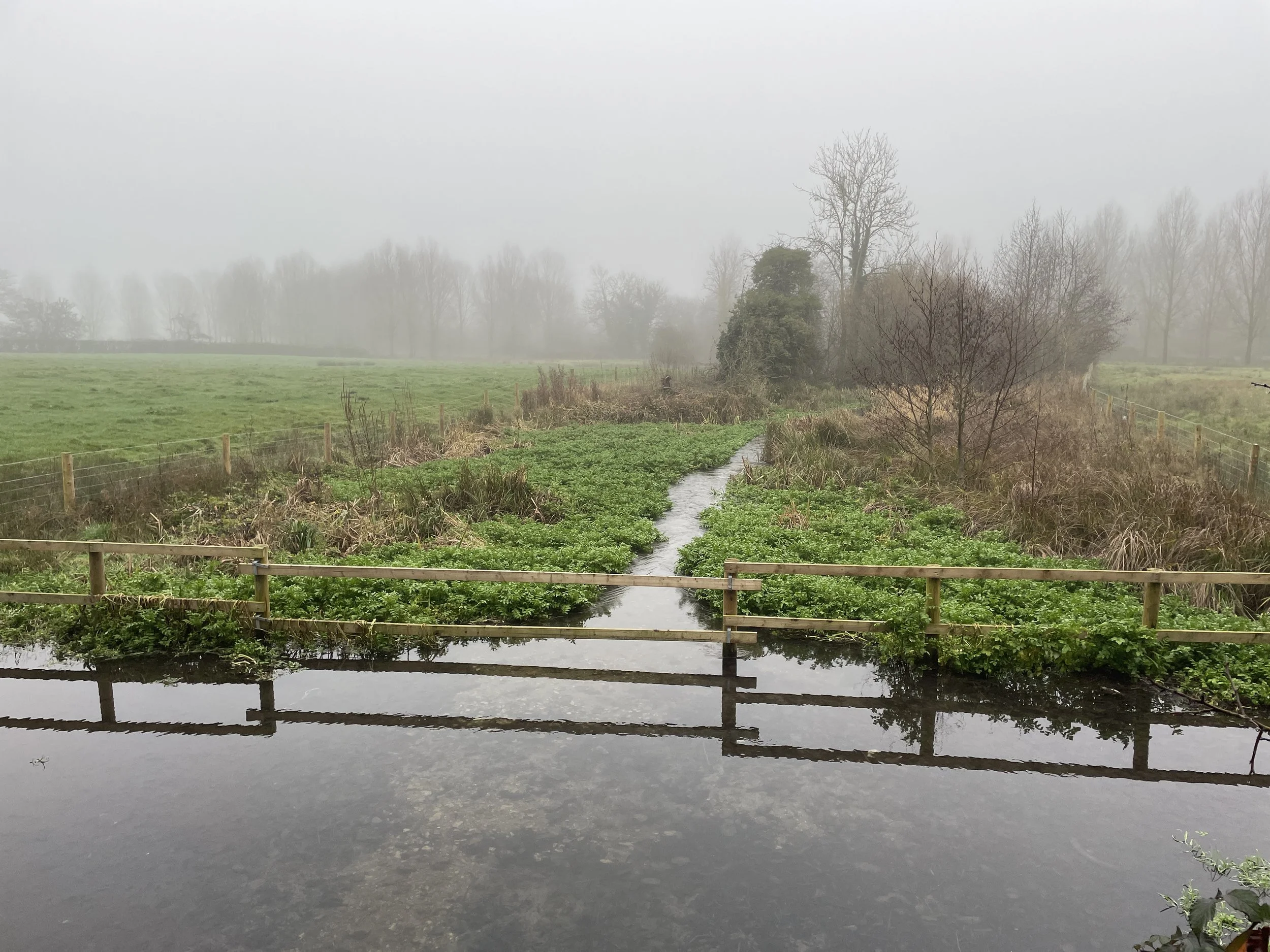
Rotten Row
The Shakespeare’s Way is a 235 km / 146 mile mile long-distance path connecting Shakespeare's birthplace in Stratford-upon-Avon with the Shakespeare's Globe (Theatre), Southwark, London. A 34km section of the path cuts through the Chiltern Hills National Landscape in a south-easterly direction. Our walks take in short sections of the Shakespeare’s Way and loop back to the start on other paths. The Shakespeare’s Way is reasonably well marked however you’ll need a map or GPX route to keep on track for the return sections of the loops. The guidance below will help but don’t use it as a fully accurate turn-by-turn guide.
Point to Point: Britwell Salome to The Grand Union Canal at Yiewsley
Start: Britwell Salome, Watlington, OX49 5LG
Finish: Grand Union Tow Path, Yiewsley, West Drayton, UB7 7XN
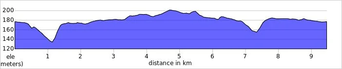
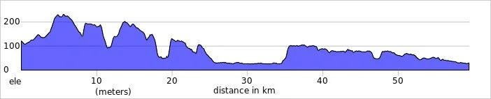
Distance: 59 km (36.7 miles)
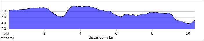
Elevation change: + 665 / - 755m. Net +90m
GPX File: get via Buy Me a Coffee
Maps: See individual section posts linked below.
- Chiltern Hills West Map | Henley-on-Thames & Wallingford | Ordnance Survey | OS Explorer Map 171
Links: Shakespeare’s Way (LWDA), See individual section posts linked below for other links.


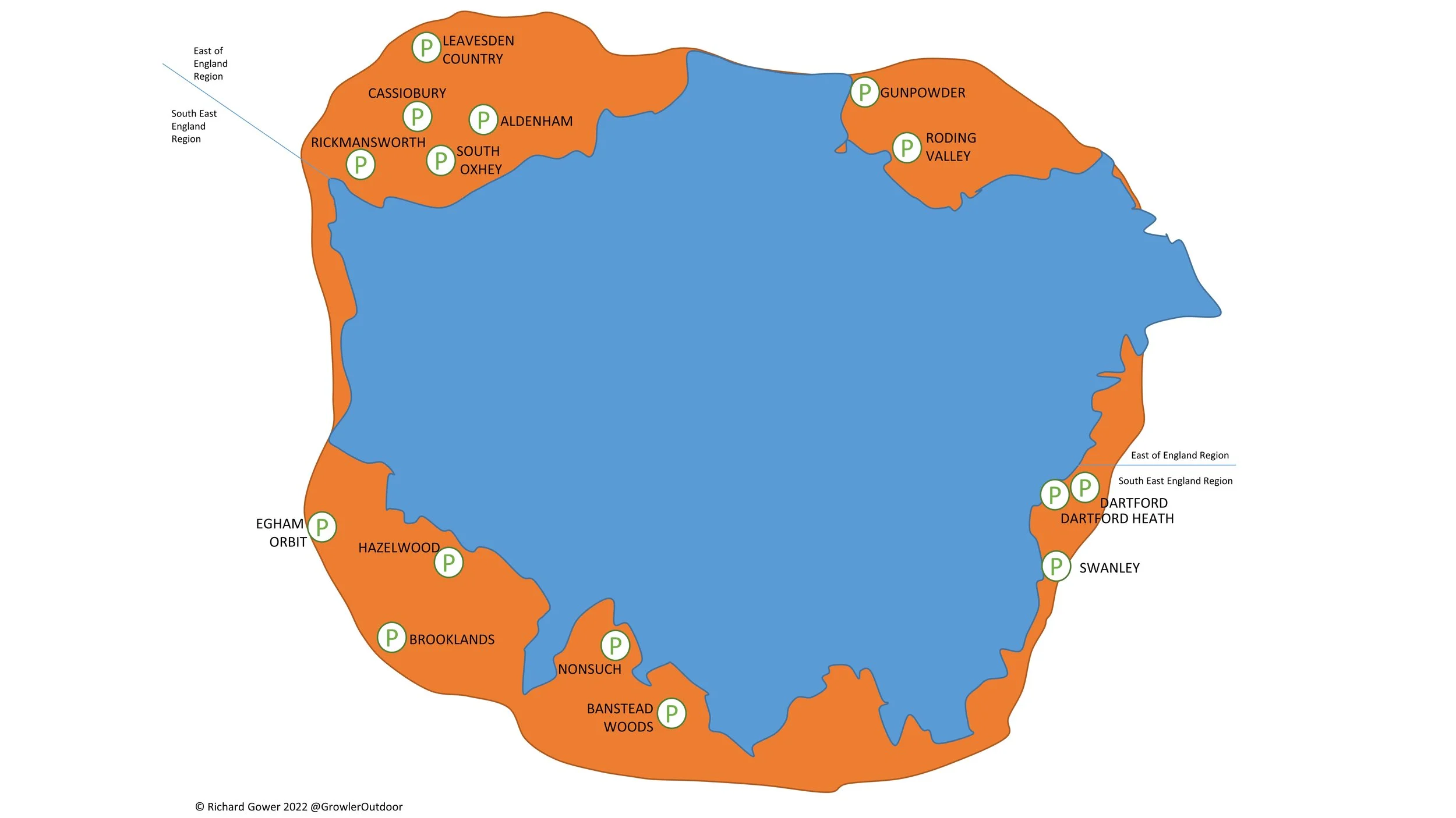
Walking The Shakespeare’s Way Chilterns Section in 12 Circular Routes
If you’re not up for an 59 km walk in one go, you can take in the Shakespeare’s way in 12 circular walks of between 6 and 13 km each. We chose this option, completing all 12 sections over a few years from 2020 to 2025. The advantage of this option is exploring more of the villages and side paths close to the route. After Route 12 you can follow the Beeches Way to reach Yiewsley and the end of the Chilterns Section of the Shakespeare’s Way.
Note that these walks take you through the Chilterns Hills National Landscape. See the Walking The Beeches Way post for the continuation from Cookham to Yiewsley

Each number refers to a circular walk below. Base map: Esri Topo via RideWithGPS

Part 1: Britwell Salome and Lower Warren
Distance: 7.8 km (4.8 miles)
Elevation change: +/- 123m
Shakespeare’s Way section covered: Britwell Salome to The Ridgeway: 2.2 km

Part 2: Swyncombe and The North
Distance: 8.1 km (5 miles)
Elevation change: +/- 176m
Shakespeare’s Way section covered: The Ridgeway to Cookley Green: 3.8 km

Part 3: Swyncombe and Park Corner
Distance: 9.9 km (6.2 miles)
Elevation change: +/- 199m
Shakespeare’s Way section covered: Cookley Green to The Chiltern Way near Maidensgrove: 2.1 km

Part 4: Nettlebed, Park Corner and Maidensgrove
Distance: 8.5 km (5.3 miles)
Elevation change: +/- 159m
Shakespeare’s Way section covered: The Chiltern Way near Maidensgrove to Park Lane: 1.2 km

Part 5: Russell's Water, Pishill and Maidensgrove
Distance: 9.2 km (5.7 miles)
Elevation change: +/- 166m
Shakespeare’s Way section covered: Maidensgrove Common to farm at south Maidensgrove: 1.32 km

Part 6: Stonor and Turville Heath
Distance: 10 km (6.2 miles)
Elevation change: +/- 208m
Shakespeare’s Way section covered: Farm at south of Maidensgrove to Southend: 5.9 km

Distance: 12.3 km (7.6 miles)
Elevation change: +/- 216m
Shakespeare’s Way section covered: Southend to Hambleden: 5.4 km

Part 8: North-east Hambleden Circular
Distance: 9.7 km (6 miles)
Elevation change: +/- 145m
Shakespeare’s Way section covered: Hamble Brook to Rogues Plantation: 2.9 km

Part 9: Bovingdon Green and Shillingridge Wood
Distance: 10.9 km (6.8 miles)
Elevation change: +/- 152m
Shakespeare’s Way section covered: Rogues Plantation to Pullingshill Wood: 2.5 km

Part 10: Marlow and Harleyford
Distance: 10.2 km (6.3 miles)
Elevation change: +/- 94m
Shakespeare’s Way section covered: Pullingshill Wood to The Thames Path at Marlow: 3.4 km

Distance: 11.4 km (7 miles)
Elevation change: + / - 65m
Shakespeare’s Way section covered: The Thames Path at Marlow to Bourne End Rail Bridge: 3.4 km

Part 12: Bourne End, Cookham and Wooburn
Distance: 8.2 km (5.1 miles)
Elevation change: +/- 83m
Shakespeare’s Way section covered: Bourne End Rail Bridge to Broad Lane, Widmoor: 3.9 km