Chiltern Walks: Chalfont St Giles and Newlands Park

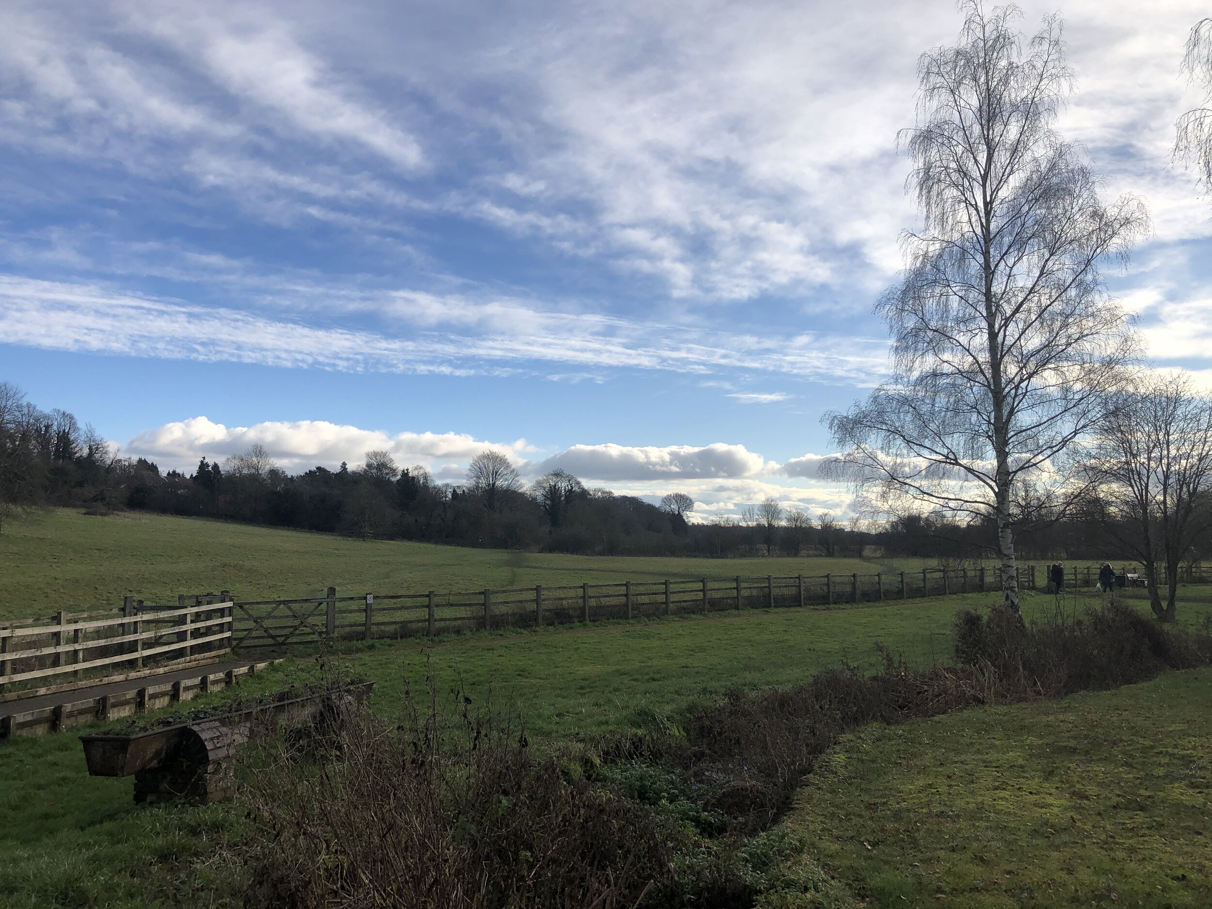
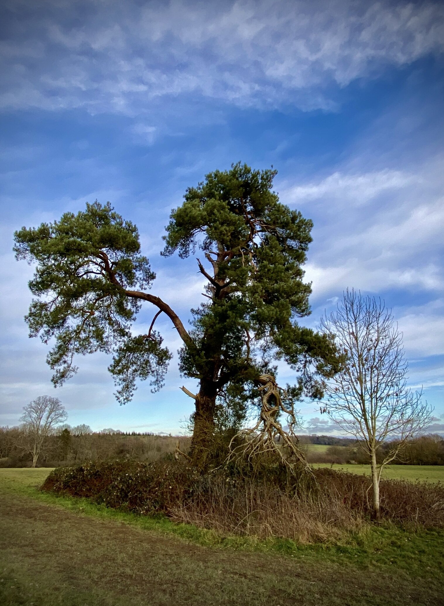
Fields at eastern end of Newlands Park
Start & Finish: Chalfont St. Giles Village Centre, HP8 4QF
Distance: 8.6 km (5.3 miles)
Elevation change: + / - 75m
Chiltern Heritage Trail Section Covered: Newland Gorse to Chalfont Common: 4.6 km
GPX File: get via Buy Me a Coffee
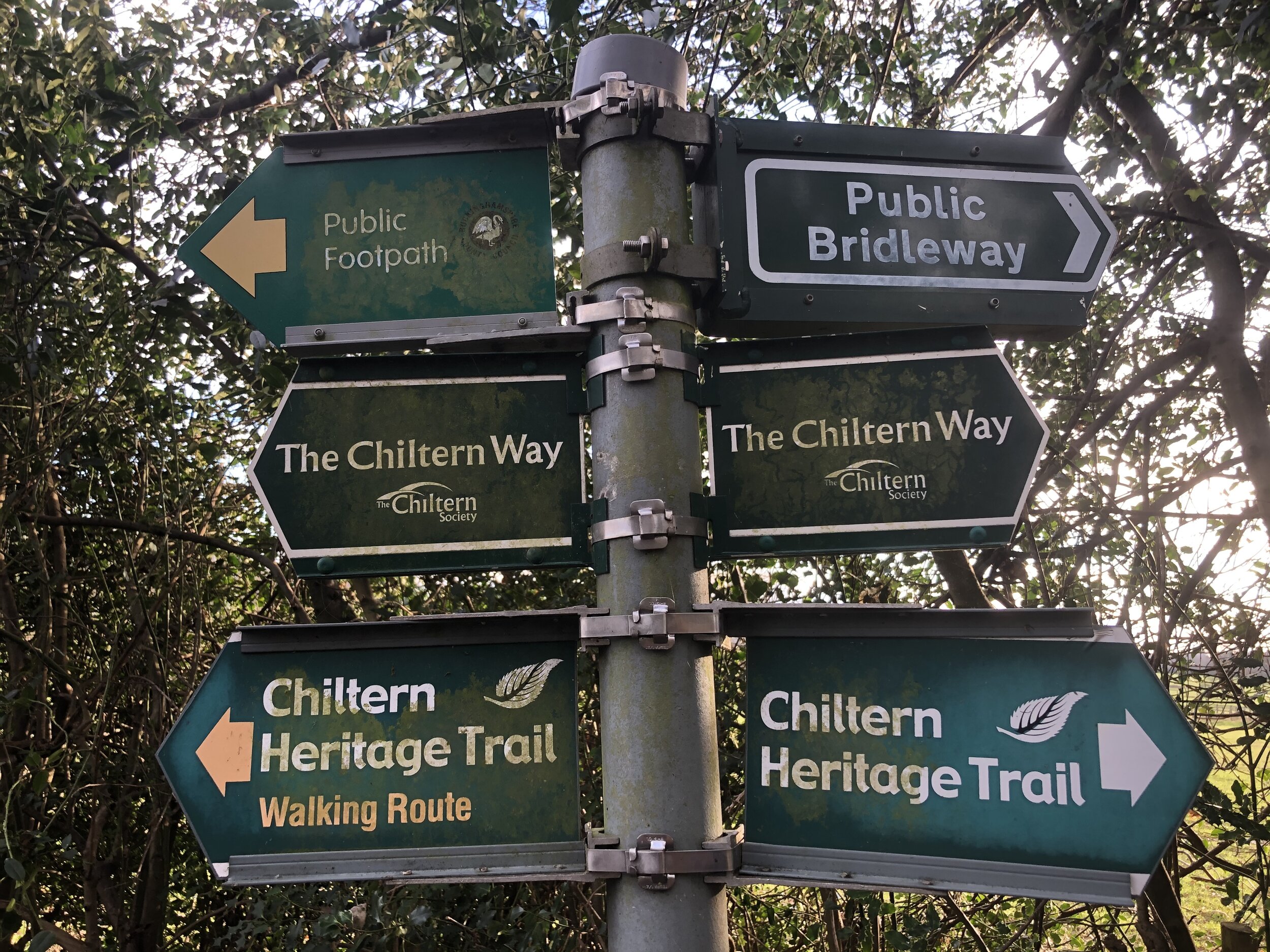
Other routes touched (walk): Chiltern Way, Chiltern Heritage Trail, South Bucks Way
Other routes touched (cycle): Chiltern Heritage Trail Milton Route
Pubs / Cafes on route: Several in Chalfont St. Giles Village Centre
Map: OS Explorer Map (172) Chiltern Hills East
Links: Chalfont St Giles, Newlands Park, Philipshill Wood, Chalfont Centre for Epilepsy, Gott’s Monument, River Misbourne
This is part of a series of short circular walks in the Chilterns. It’s a part of a series of 17 walks that, between them, cover the 83 km of the Chiltern Heritage Trail. Created as a Millennium project, this trail links the towns and parishes within the district, offering stunning scenery, charming villages, and points of historical interest. The guidance below will help you navigate but don’t use it as a fully accurate turn-by-turn guide. Always take a map and/or a GPX route and prepare well for the weather and terrain.
From the village centre you’ll follow the Chiltern Way in an easterly direction over fields, across the A413 then up a steep hill. Soon you’ll pass the picturesque H2 construction site for one of the Chiltern tunnel vents. Continue along the Chiltern Way as it enters the Newlands Park Estate, curving around its perimeter.
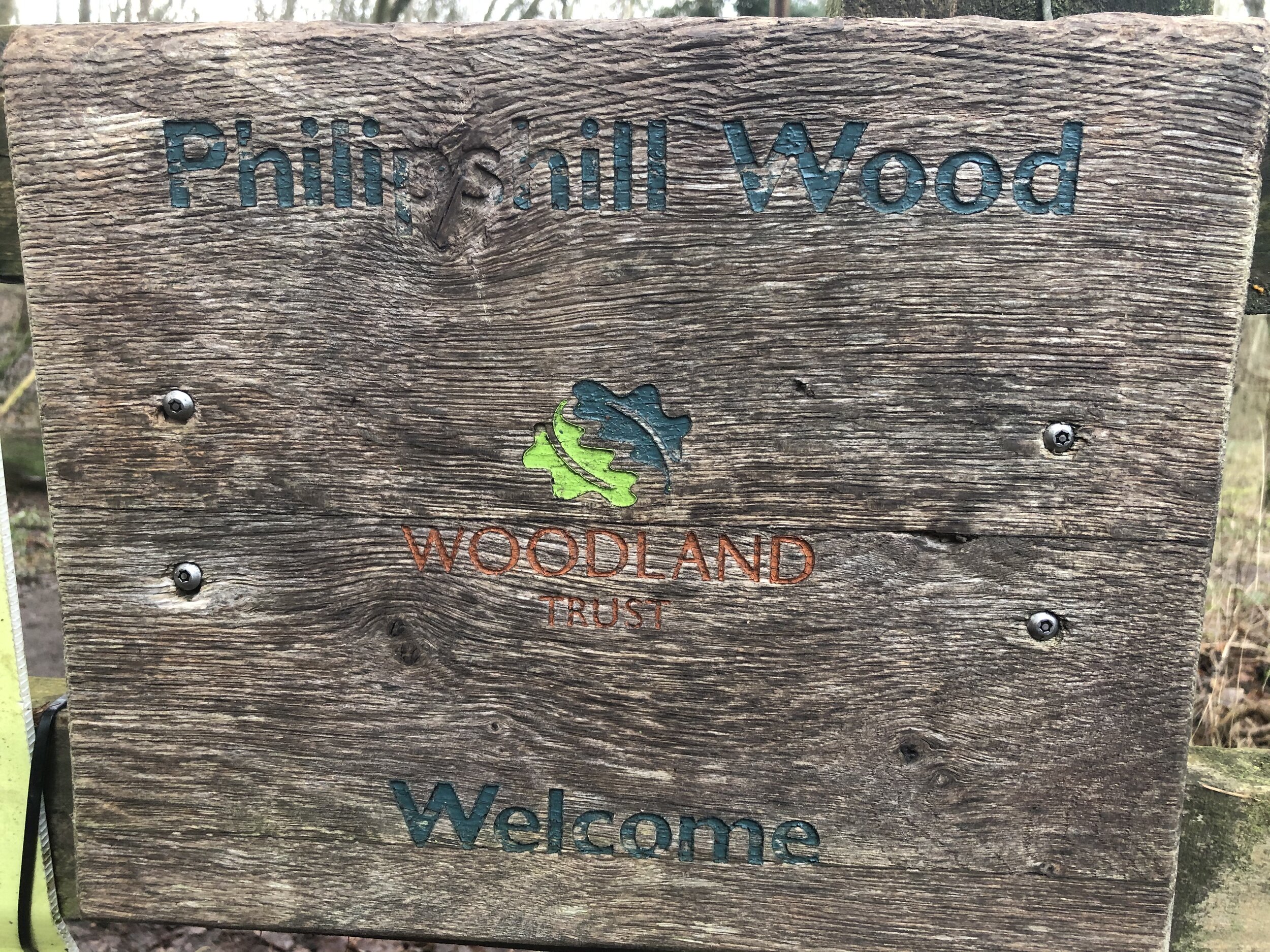
Approximately 3 km into the trip you’ll meet a path junction in Philipshill Wood. Instead of taking a left turn to continue on the Chiltern Way, continue straight on, keeping to the left of the boundary of Newlands Park. After ~350m take a right hand path (Old Shire Lane), again keeping Newlands Park on your right. After ~600 metres, take a right hand path back into Newlands Park and follow the path toward then over Gorelands Lane. Continue in a south-westerly direction through farmland and into the Chalfont Centre for Epilepsy.
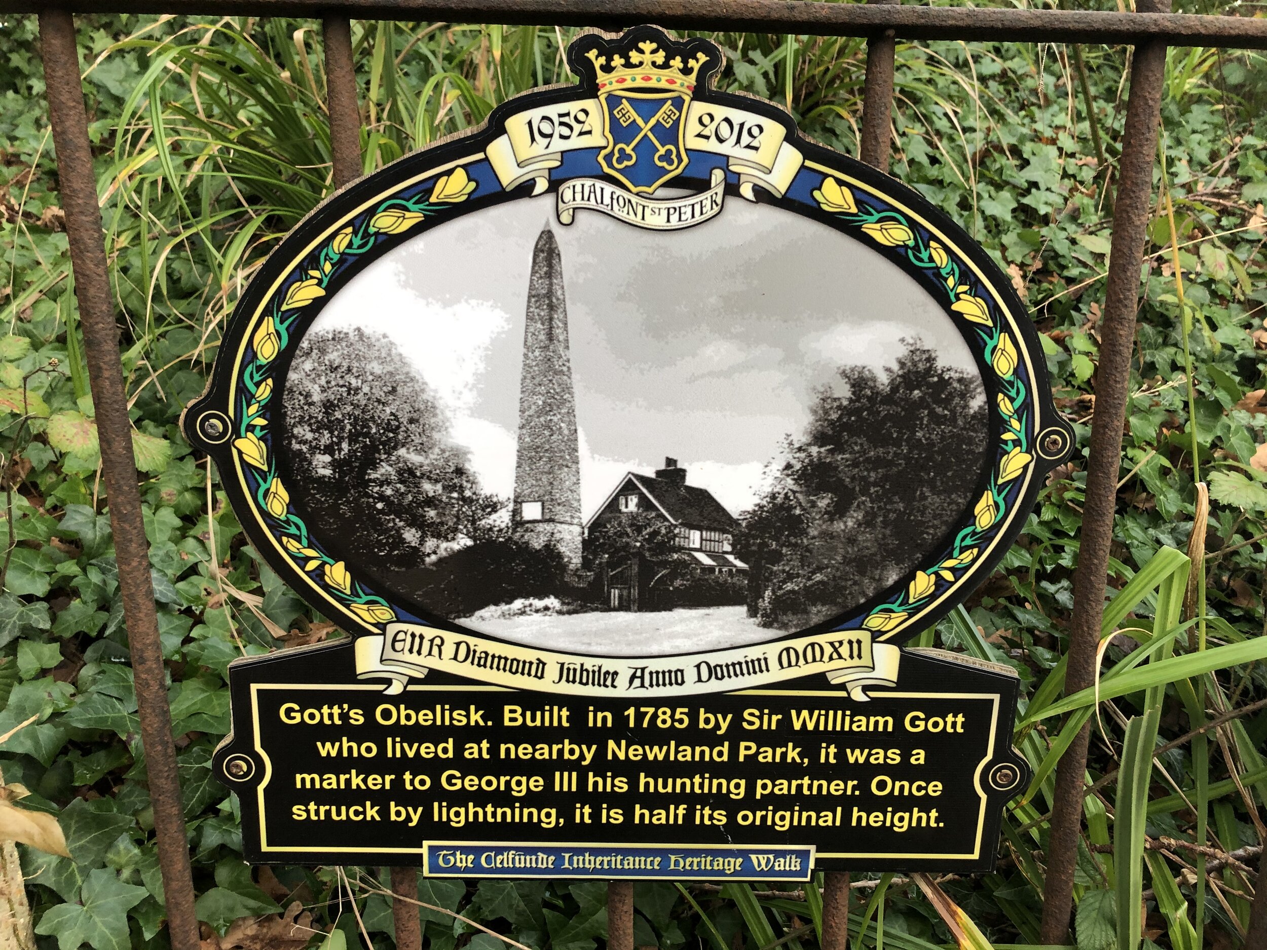
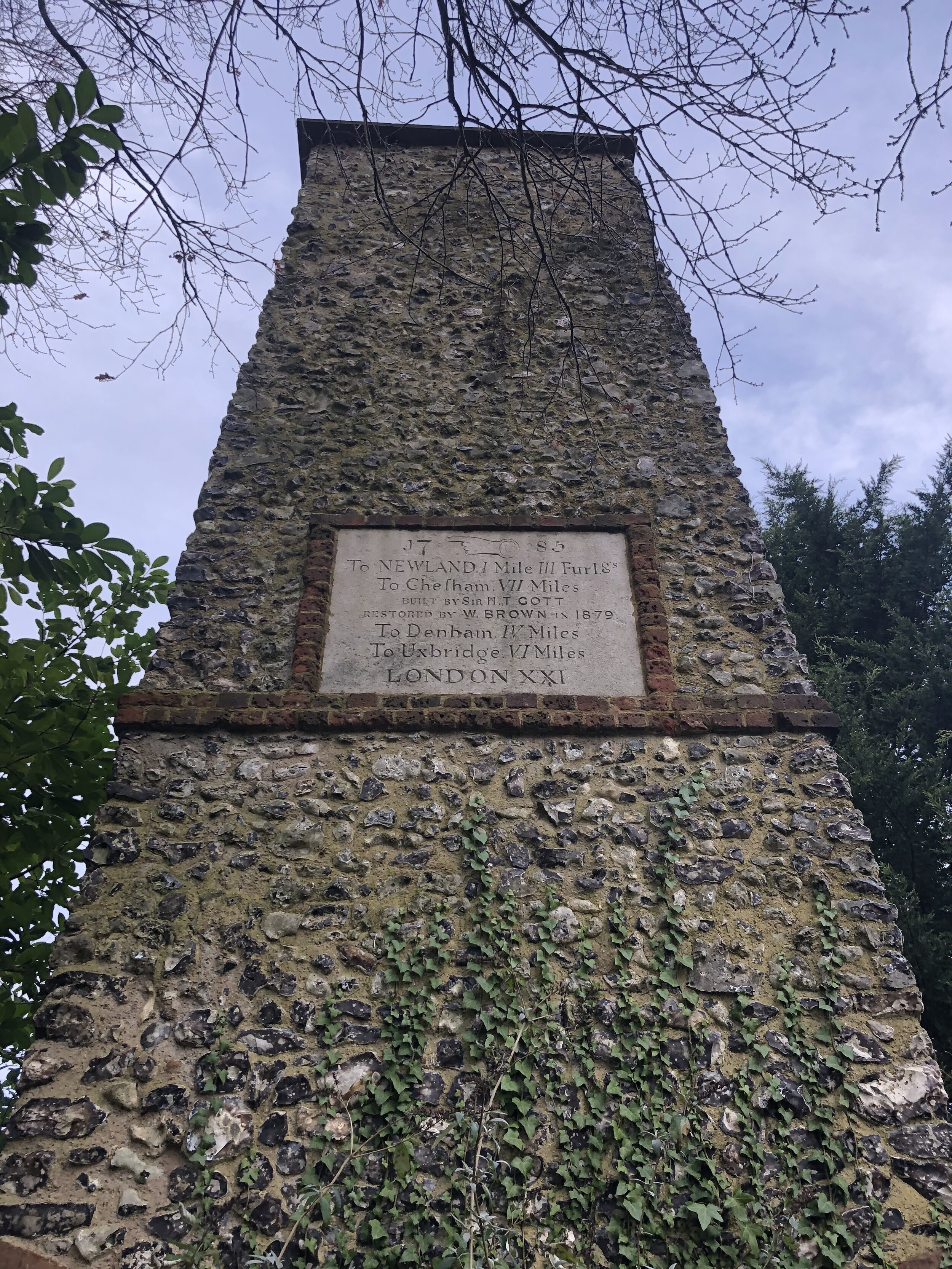
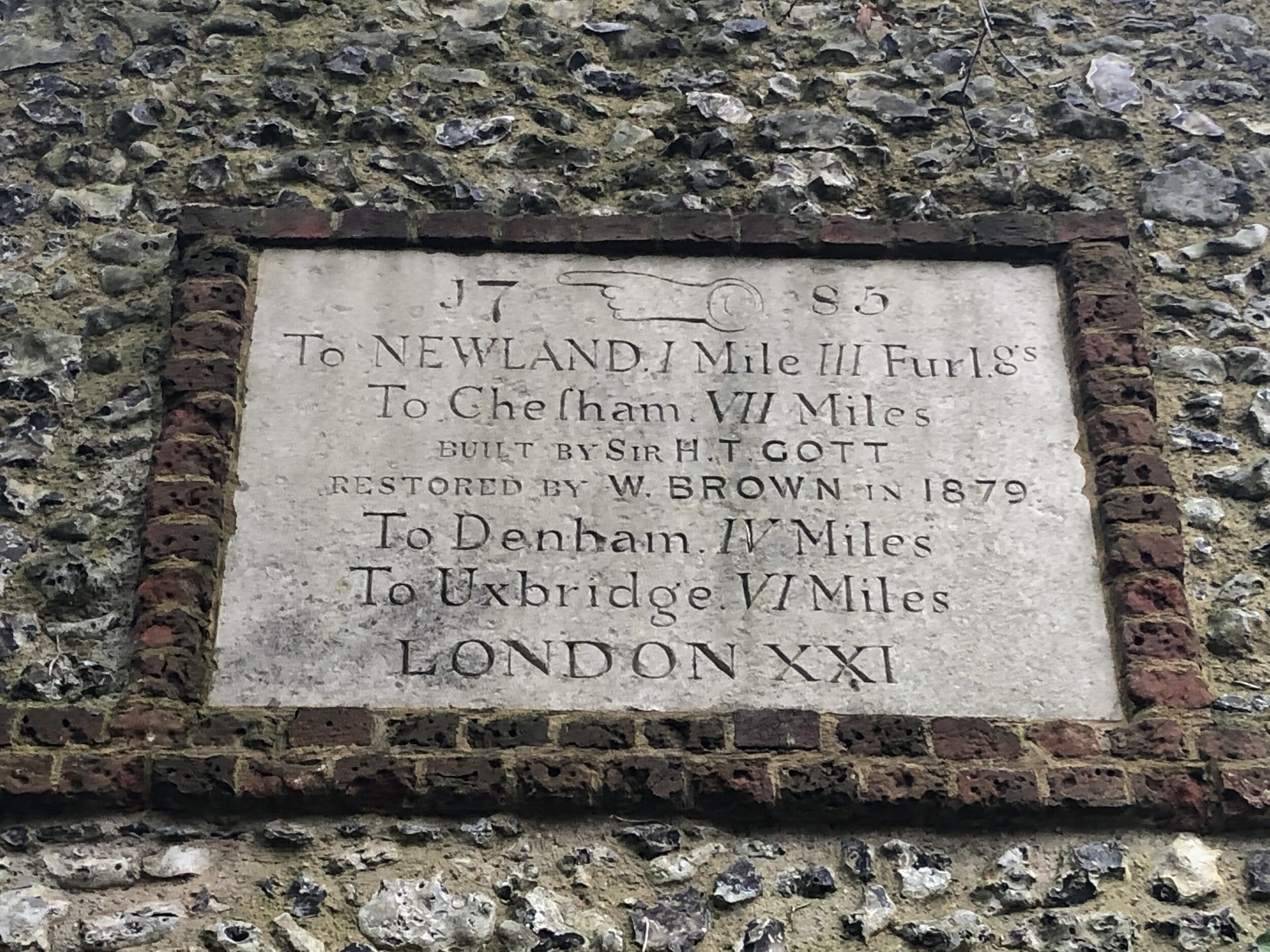
To the right of the main gate of the Centre for Epilepsy, look out for Gott’s Obelisk. According to the plaque, it was “… built in 1785 by Sir William Gott who lived at nearly Newlands Park, it was a marker to George III his hunting partner. Once struck by lightning it is half it’s original height”.
From the monument, take Misbourne Avenue down to the A413, take a left and briefly follow the main road until you see a footpath sign on the right. Carefully cross the road and take the path across the River Misbourne until you meet the Chiltern Heritage Trail. Turn right onto the trail and follow it back to Chalfont St. Giles.


Chiltern Heritage Trail next section clockwise: Chalfont St Peter, Seer Green and Chalfont St Giles
Chiltern Heritage Trail next section anti-clockwise: Phillipshill Wood and Hanging Wood